The Trans-Canada Highway is the fastest and most efficient way to get through Banff National Park. But, for those visiting Banff who have a sense of adventure and a little extra time on their hands, we recommend a scenic drive along the Bow Valley Parkway instead.
With a lush forest, epic mountain scenery and excellent wildlife spotting opportunities, driving the Bow Valley Parkway is a must-do attraction in Banff National Park.

This post contains compensated links.
What Makes The Bow Valley Parkway Special?
The Bow Valley Parkway is a 48 kilometer secondary highway that connects Banff to Lake Louise. Originally built in 1920, this highly scenic route through Banff was built with vehicle sightseeing in mind. As you’ll see, there are plenty of hikes, roadside pullouts and fun things to do along the Bow Valley Parkway.
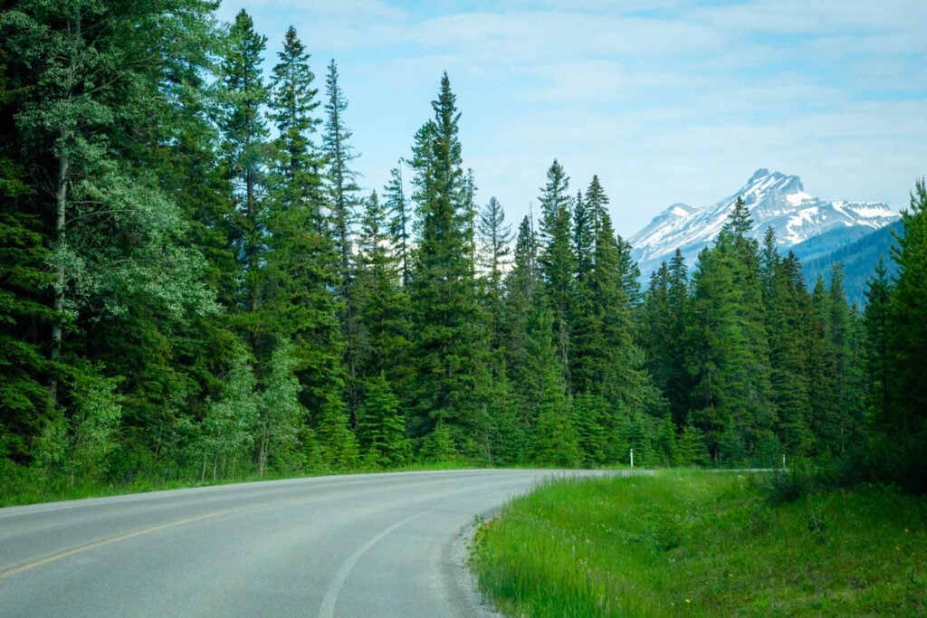
Also known as Highway 1A, the Bow Valley Parkway is a prime habitat for wildlife in the Bow Valley. Thanks to its lower elevation, diverse vegetation, plenty of sunshine and a lack of wildlife fences, the Bow Valley Parkway is an ideal place to spot wildlife in Banff.

With a speed limit of just 60 km/h (compared to 110km/h on the Trans-Canada Highway), the Bow Valley Parkway is a more leisurely drive from Banff to Lake Louise. We feel that the slower pace, coupled with plenty of excellent attractions and a chance to see wildlife makes this an excellent choice for a scenic drive in Banff. We highly recommend a scenic drive on the Bow Valley Parkway during your visit to Banff National Park.
Read More
The Bow Valley Parkway is just one of the amazing scenic drives in Banff National Park.
Things to Know About Highway 1A
Where is the Bow Valley Parkway?
One of the most scenic drives in Banff National Park, the Bow Valley Parkway runs in an east-west direction parallel to the Trans-Canada Highway between Banff and Lake Louise.


Don’t miss out on ANYTHING in Banff!
Our comprehensive Banff Travel Guide has EVERYTHING you need to plan the best trip without feeling overwhelmed or that you’ll miss out.
Bundle one of our pre-built itineraries with your Banff Travel Guide and take all the stress out of planning your trip!
Where to Get onto Highway 1A
There are three access points to the Bow Valley Parkway:
Fireside Entrance: The eastern end of the scenic drive begins just 15 km west of the Mount Norquay overpass. This access point is often referred to as “Fireside” due to the proximity of the Fireside picnic area.
Castle Junction Entrance: If you continue driving on the Trans-Canada Highway for another 24 km past Fireside, you’ll reach Castle Junction – the second access point to the Parkway. This access point provides the quickest access to Johnston Canyon – the star attraction along this scenic drive.
Lake Louise Entrance: The western end of this scenic route is along the road to the Lake Louise Ski Resort – just a minute away from the Trans-Canada Highway. If you have the time, the Lake Louise summer sightseeing gondola is a lot of fun and provides a great opportunity to see grizzly bears from above.

Highway 1A Mandatory Travel Restrictions
There are a variety of travel restrictions along the Bow Valley Parkway:
Cycling the Bow Valley Parkway Pilot Project
The eastern section of the Bow Valley Parkway (meaning the section from the Fireside Picnic Area to Johnston Canyon) will have restricted public vehicle access in the Spring and Fall. Making cycling the Bow Valley Parkway one of the best things to do in Banff in September.
Between 2025-2030, no public vehicles will be allowed on the eastern section of Highway 1A as follows:
- Spring closure: May 1 to June 25.
- Fall closure: August 28 to October 2.
The western section of the Bow Valley Parkway, from Johnston Canyon to Whitehorn Road near Lake Louise will remain open to vehicle traffic.

Seasonal Travel Restriction
In addition to the pilot project for cycling the Bow Valley Parkway, there is an annual road closure in effect every spring to protect our precious wildlife who call this scenic route home.
No activity is allowed on the Bow Valley Parkway (including cars, bikes, walking, etc) between Firestone and Johnston Canyon Campground between 8 p.m. and 8 a.m. every year from March 1st to June 25th. This section of road is through montane forest – a critical habitat for large carnivores, such as bears, wolves and cougars. The evening road closure helps protect these important, amazing animals.

Best Things to Do Along the Bow Valley Parkway
In the next section we highlight every single thing to do along the Bow Valley Parkway below, but realistically no one wants to stop at every single stop on this scenic route. So, to help you make the most of your Banff scenic drive, here are our recommendations for the best things to do on the Bow Valley Parkway.
Best Overall Attraction: Johnston Canyon Hike

Best Hike: Castle Mountain Lookout Hike
Best Viewpoint: Morant’s Curve

Best Picnic Area: Coral Creek
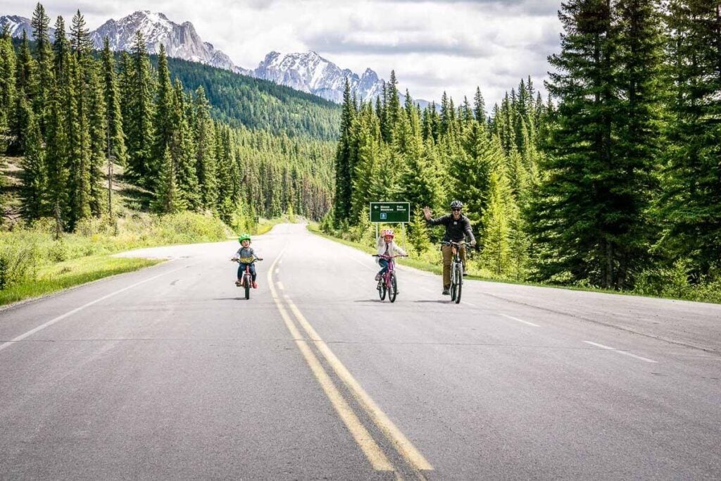
Best Activity: Cycling the Bow Valley Parkway
Bow Valley PArkway Audio Tour
Of all the apps you should have for your trip to Banff, the GuideAlong app should be top of your list, especially if you intend on enjoying the many scenic drives in the Canadian Rockies.

Recommended App
This GPS activated Canadian Rockies Audio Driving Tour is the perfect companion to your Banff vacation. It’s both entertaining and educational and will greatly enhance any drive in Banff National Park. Use code TRVLBANFF for 15% off!!
A Complete List of Things to do on the Bow Valley Parkway
As you can see, there are an abundance of excellent stops along Highway 1A. Please note that in addition to the attractions listed below, there are lots of unmarked pullouts along this scenic route.

Some are to allow slower vehicles to pull over, but many also have excellent viewpoints, tranquil streams etc. If you pull into one of them, take a moment to look around before resuming your sightseeing.
For your convenience, this list of things to do on the Bow Valley Parkway is in geographical order, starting on the eastern end at the Fireside Entrance and working westward towards the Lake Louise entrance.

Fireside Picnic Area
Primarily used as the starting point for the Cory Pass hike, the Fireside Day Use area is also a pretty, well-treed picnic area along a beautiful creek which flows down in the valley between Mount Edith (2,554 m) and Mount Cory (2,802 m).
There are picnic tables scattered along the river near the parking lot, but there is also a collection of 6 tables near a stone fireplace next to the river, making it a great spot for a Banff picnic for a large group. It’s a beautiful spot indeed, but due to a bridge outage you need to get your feet wet to get there.

Facilities: Toilets, bike racks
Fireside Picnic Area – Google Maps
Cory Mountain Hike
Just beyond the Fireside day use area, is the trailhead for the Cory Mountain hike. This short hike is only 4.5 km one-way to the summit of Mount Cory, but it’s extremely steep with over 1,400 m of elevation gain. Only experienced hikers should attempt this difficult Banff hike, but those who do will be rewarded with outstanding views of the Canadian Rocky Mountains.
A recent App of the Year winner, AllTrails is also one of the best apps for visiting Banff! Enjoy map downloads and many more premium features with a 7-day free trial of AllTrails+!

Backswamp
Backswamp is a small unmarked viewpoint just 3 km into the Bow Valley Parkway scenic drive. From the Backswamp lookout you’ll enjoy outstanding views of Mount Bourgeau (2,930 m) with the Bow River in the foreground. If you are lucky, a train will run past just below you.
Note that Backswamp is located just before the first section of one-way road on the Bow Valley Parkway, so if you find yourself on a one-way road, you’ve gone too far.

Muleshoe Picnic Area
A large, beautiful picnic area along the Bow Valley Parkway, Muleshoe is a great spot to stop for a scenic break along the shores of tranquil Muleshoe Lake (which was once a part of the nearby river).
Located in a rare section of montane forest in Banff National Park, this area is rich in wildlife. The forest surrounding the 12 picnic tables consists of old growth aspens and towering evergreen trees. The sound of the trembling aspen leaves is very relaxing.

From the interpretive signs near Muleshoe Lake, you can see a massive cave called Hole-in-the-Wall on nearby Mount Cory.
A pair of iconic Parks Canada red chairs are found here as well.

Facilities: large parking lot, toilets
Muleshoe Picnic Area – Google Maps
Muleshoe Ridge Hike
The Muleshoe Ridge hike departs from the Muleshoe picnic area. The Muleshoe Ridge trail is only 2.5 km one way to the top, but as with the Mount Cory hike, it’s extremely steep with over 800 m of elevation gain. This trail is for experienced hikers only.
Sawback Prescribed Burn
As you drive along this scenic road to Lake Louise, you may be startled to suddenly come across a large section of burnt forest. This was the result of multiple planned forest fires between 1985 and 2014 to restore sections of Banff National Park to a more natural state.
Intentionally setting a forest fire is a big departure from previous Banff National Park management strategies which used to aggressively put out forest fires. Today forest fires are seen as vital to maintaining a healthy forest.
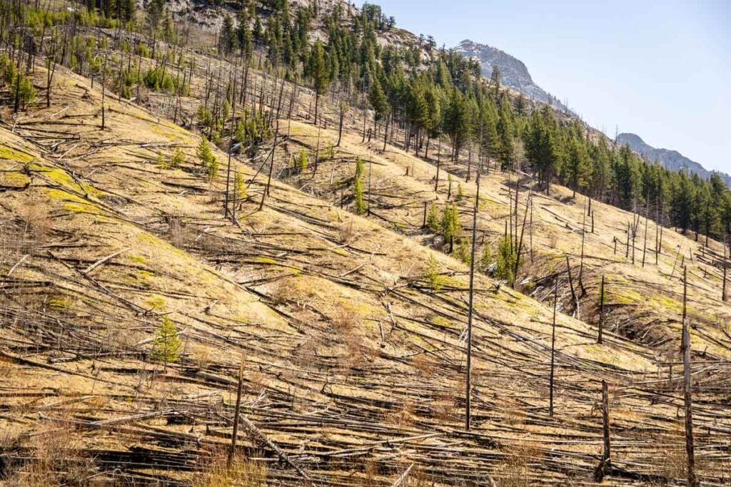
The Sawback prescribed burn is mostly seen as you drive past the remnants of the fire, but there there is a small pullout with interpretive signs toward the western end of the burn zone.
Sawback Forest Fire Area – Google Maps
Sawback Picnic Area
A small, but beautiful Banff picnic area in a mixed forest of aspen trees and evergreens. The Sawback picnic area is a small loop with 11 picnic tables. For those cycling the Bow Valley Parkway there are bike racks.

Facilities: There is a simple outhouse toilet here.
Sawback Picnic Area – Google Maps
Hillsdale Meadows
A small but scenic roadside pullout offering 360-degree views of the surrounding Canadian Rockies. A meadow full of wildflowers adds to the beautiful scenery on display here.

Hillsdale Meadows – Google Maps
Pilot Pond Lookout
Pilot Pond is home to a very special Banff resident – the long-toed salamander. A misinformed decision to stock the lake with fish resulted in the native salamander population plumutting, but a few hardy salamanders survived. Now that they no longer stock fish in the lake, the salamanders are starting to return again.
There’s a short trail from the parking lot to the shores of Pilot Pond. This sensitive area is often subject to seasonal closures, so please obey any Parks Canada signage. These long-toed salamanders have had enough challenges – let’s do what we can to help them thrive.

Note: Pilot Pond is on one of the one-way sections of roadway and is only accessible for those traveling eastbound making it a good stop for those returning to downtown Banff from Lake Louise or the Johnston Canyon hike.
Johnston Canyon Hike
One of the most popular attractions in Banff National Park, a visit to Johnston Canyon is highly recommended for those driving the Bow Valley Parkway. In fact, it’s not only one of our favorite easy hiking trails in Banff, it’s number one on our list of the best hikes in Banff National Park!

Johnston Canyon is one of the most popular things to do in Banff for a good reason; it’s a short, easy and incredibly scenic hike. This fun hike follows the shores of Johnston Creek deep into a tall canyon. Along the way, you’ll see many beautiful waterfalls, including the two biggest ones; the Lower Falls and the Upper Falls. Walk into a small cave and get so close to the Lower Falls that you’ll get soaked from the spray!

Due to its popularity, the two massive parking lots at Johnston Canyon can get full. To increase your chances of seeing this top Banff attraction, be sure to read our full post on the Johnston Canyon hike.
Johnston Canyon is served by two public transit bus routes. Roam routes 8S and 9 both have bus stops at Johnston Canyon. The Banff Hop-On Hop-Off bus also stops at Johnston Canyon.
Moose Meadows Hike
Poor Moose Meadows is often overlooked as visitors whiz by on their way to its more famous neighbour, Johnston Canyon. This is a shame as Moose Meadows is a beautiful, and significantly less crowded hike through a lush forest. The best part? The Moose Meadows trail ends at the Johnston Canyon Upper Falls!

The Ink Pots
Regardless of whether you get there via the Johnston Canyon trail or the Moose Meadows trail, once at the Upper Falls, hikers have the option to continue hiking to the Ink Pots. The Ink Pots are deep pools of water which come alive with color on a sunny day. The blue-green color of the Ink Pots never ceases to amaze and the views of the surrounding Canadian Rockies are nothing short of spectacular.

From the Upper Falls, it’s an additional 2.7 km (one-way) to the Ink Pots through a charming forest. For more information, please read our post all about hiking to the Ink Pots.
Moose Meadows Pullout
A pleasant meadow with nice views of Pilot Mountain (2,935 m), this is a good opportunity to see some wildlife. Moose used to be seen in this meadow 50-70 years ago, but now visitors are more likely to see deer and elk.

Moose Meadows Viewpoint – Google Maps
Rockbound Lake Hike
One of the most popular challenging Banff hikes along the Bow Valley Parkway, the Rockbound Lake trail gives ample rewards for your efforts. From the trailhead near Castle Junction, the Rockbound Lake hike leads you up the southern slopes of Castle Mountain (2,766 m), ultimately taking you behind this iconic Banff mountain peak.
About halfway up this difficult hike, the trail levels out and you enter a valley in-between Castle Mountain and Helena Peak (2,862 m). You’ll pass the small, but charming Tower Lake on your way to Rockbound Lake.

The Rockbound Lake hike is 9 km (one way) with over 1,000 m of elevation gain and takes roughly 7 hours to complete. It’s also one of the best larch hikes in Alberta!
Get all the information you need about the Rockbound Lake hiking trail in our full blog post.
Silverton Falls Trail
One of the rare easy hikes along the Bow Valley Parkway, the Silverton Falls hike is a popular choice for those looking for an alternative to the very busy Johnston Canyon trail. Silverton Falls shares the same trail as Rockbound Lake for a bit, but after 300 m the hiking trails diverge, with Silverton Falls going to the right.
It’s a short 900 m walk to the towering Silverton Falls. This is a good hike for those looking for a scenic waterfall with little effort involved.

Get all the information you need about the Silverton Falls Trail in our full blog post.
Castle Cliffs View
A short paved trail leads from a tiny parking lot to a wooden platform with amazing views of Castle Mountain. One of our favourite Banff mountains, Castle has majestic towering cliffs which are on full display here.
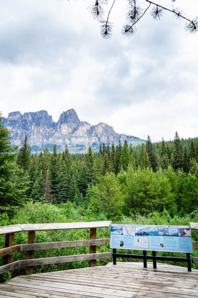
A tranquil creek flows near the platform, providing pleasant sounds of water flowing and abundant birdsong. The Castle Cliffs Viewpoint is an especially nice place for sunset pictures.
Castle Cliffs Viewpoint – Google Maps
Storm Mountain Lookout
This roadside pullout along the scenic route between Banff and Lake Louise provides a beautiful viewpoint of Storm Mountain (3,100 m) along with a close up view of the Bow River and CPR train tracks.
The mountains visible across the Bow Valley, including Storm Mountain, are part of the continental divide. Rain falling on this side flows to the Hudson Bay, while rain on the other side flows to the Pacific Ocean.

This roadside attraction features a large parking lot, a few picnic tables and toilets.
Storm Mountain Lookout – Google Maps
Internment Camp Memorial Pullout
During World War I, Canada imprisoned certain individuals from the Austrio-Hungarian Empire deemed to be a security risk. These prisoners of war were held at a series of internment camps across Canada, including one not far from this interpretive exhibit.

Those who stop at the Internment Camp pullout will learn a great deal about this troubling time in Canada’s past. For those who are interested in more information about Canada’s internment camps, there is a better exhibit found at the Banff Cave and Basin, another of the must-see attractions in the national park.
Internment Camp Memorial – Google Maps
Castle Lookout Hike
If you are looking for a moderately difficult hike to a panoramic viewpoint, we highly recommend the Castle Mountain Lookout hike. Just under 4 km long (one-way), the views of the Canadian Rockies get better and better as you near the Castle Mountain Lookout.

Once you arrive at the end of this scenic hike, you’ll be rewarded with a complete panorama of the mountains stretching as far east as Canmore. And, perhaps even between, you’ll get an up-close view of the huge rock slabs that make Castle Mountain so famous.

Get all the information you need about the Castle Lookout Hike in our full blog post.
Baker Creek Picnic Area
Another hidden gem just across the highway from the Baker Creek Mountain Resort, this picturesque picnic area sits next to the beautiful Baker Creek.
A very shady Banff picnic spot, this is an excellent spot to see wildlife – we saw a majestic bull elk in the forest on our most recent visit. The creek and the adjacent meadow are prime habitat for some of Banff’s most beautiful creatures.

The Baker Creek picnic area has about 8 picnic tables, and a short, paved walking trail along the creek.
Facilities: There is a simple outhouse toilet here and parking for approximately 30 vehicles.
Baker Creek Picnic Area – Google Maps
Morant’s Curve
Morant’s Curve is one of the most famous photography spots in Banff National Park. This photogenic spot was named for Nicholas Morant, a photographer for Canadian Pacific Railway. Parks Canada often used his photos to promote Banff and Lake Louise.
Due the popularity of this photo op, you may find it hard to get a parking spot in the small parking area. But, if you do get a spot, you’ll need to safely cross the Bow Valley Parkway to the viewpoint.
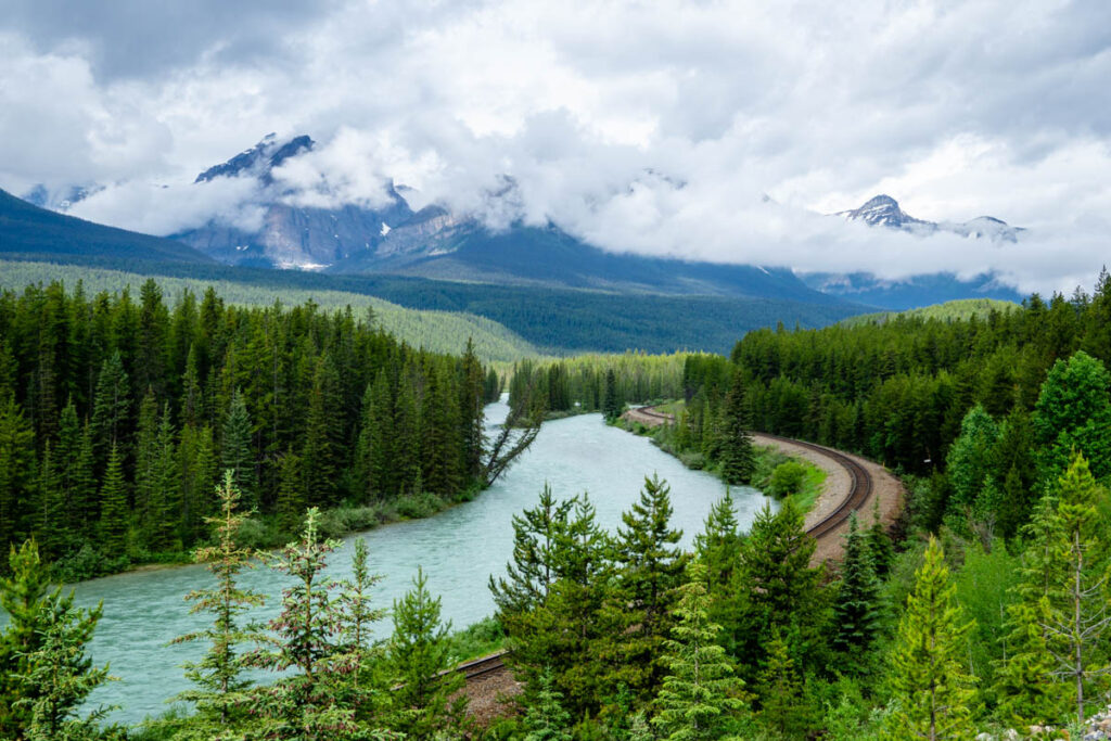
Morant’s Curve is famous as you can see an S-shaped curve in the CPR train tracks alongside the turquoise coloured glacier fed Bow River with the dramatic Lake Louise area Rocky Mountain peaks as a backdrop. If you wait patiently for a train (which typically come every 15-20 minutes), you’ll get a very Canadian photograph to remember your trip by.
Coral Creek Picnic Area
The Coral Creek Picnic Area is a real hidden gem along the BVP. This small creekside clearing is a perfect spot for a picnic near Lake Louise. Enjoy the sound of rushing water while you enjoy the views of Mount Temple (3,544 m) through the trees. There is a beautiful stone fireplace next to the river and many of the picnic tables have charcoal bbqs.

Facilities include toilets, garbages, recycling and 20 parking spots.
Coral Creek Picnic Area – Google Maps
The Lake Louise Entrance of the Bow Valley Parkway
It will be bittersweet when you reach the western end of this scenic Banff drive. You’ll arrive at a T-intersection.
Turn right for the Lake Louise ski area, which offers a sightseeing gondola in summer and world-class skiing in the winter.

Turn left to cross the Trans-Canada Highway to visit the very popular destinations of Lake Louise and Moraine Lake. Note, that if you wish to visit these extremely popular Banff attractions in peak season, you will likely need to book a shuttle due to parking limitations.
- How to Book the Lake Louise Shuttle
- How to Book the Moraine Lake Shuttle
- Best Ways to Get to Moraine Lake
3 Reasons to Stay Along the Bow Valley Parkway
There are many great reasons to stay along the Bow Valley Parkway:
- It will allow you to more slowly explore the many wonders found along this scenic drive.
- The accommodations along the parkway are not in populated centres (like Banff or Lake Louise) and really enable you to feel like you got away from it all.
- If you plan on visiting both Banff and Lake Louise during your visit, the places to stay along the Bow Valley Parkway are approximately halfway between these two popular destinations, especially the places near Castle Junction.

7 Great Places to Stay on the Bow Valley Parkway
There are many accommodation options available along this scenic drive between Banff and Lake Louise. These options are listed in geographical order, starting closest to the Fireside Entrance and work westward towards the Lake Louise entrance.
Johnston Canyon Campground
This beautiful, well treed campground with 132 campsites is conveniently located across the highway from one of the most popular attractions in the national park. The Johnston Canyon Creek (which is the river flowing through the famous canyon), finishes it’s journey to the Bow River through this campground.

Johnston Canyon Lodge and Bungalows
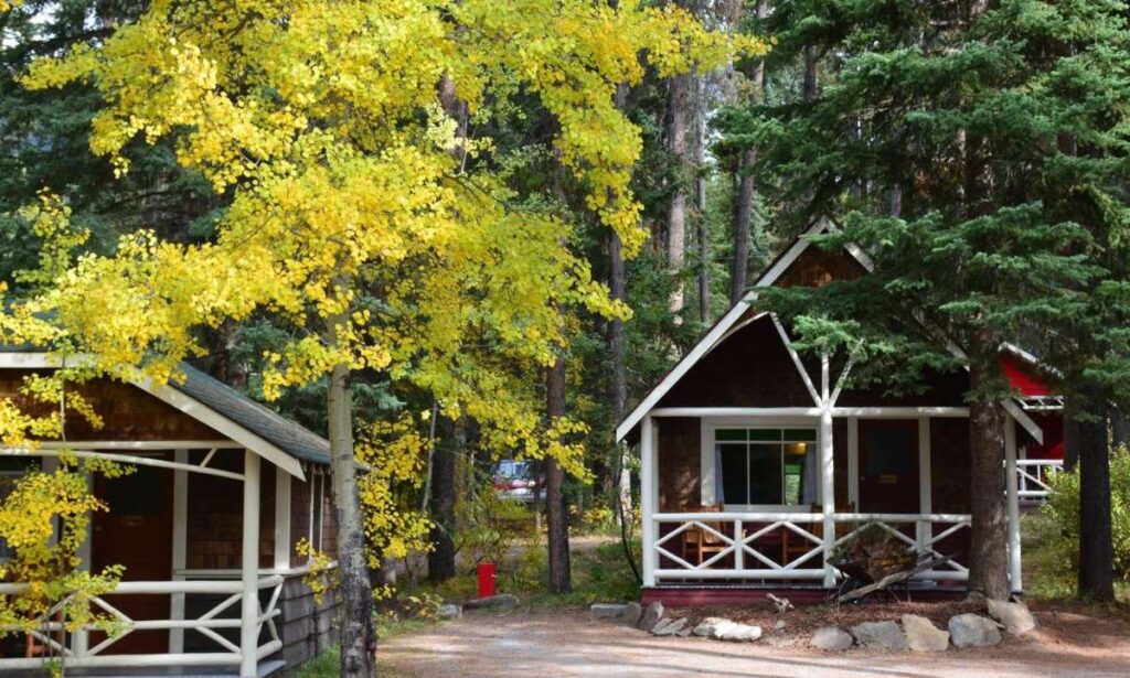
We’ve added the Johnston Canyon Lodge to our list of the Best Cabins in Banff quite simply as it’s one of our favorite places to stay in the park. The opportunity to stay in a cozy cabin adjacent to one of the most beautiful natural attractions in Canada is just too good to pass up.
Castle Mountain Campground
A small, no-frills campground with only 43 sites, the Castle Mountain campground is a convenient place to base your stay in Banff National Park. Located in-between the Silverton Falls and Johnston Canyon, you’re never far from some of the best things to do along the Bow Valley Parkway.
NOTE: The Castle Mountain Campground is closed until further notice. Check the Parks Canada campground page for updates.

HI Castle Mountain Wilderness Hostel
The HI Castle Mountain hostel is a great option for those visiting Banff on a budget. A classic backpackers hostel, you’ll be staying in a 14-bed room with ladies-only or mens only options.
Hosteling International Canada is no stranger to Banff hospitality. In fact, they have a hostel on our list of the Best Places to Stay in Lake Louise.
Castle Mountain Chalets
The Castle Mountain Chalets not only appear on our list of the Best Cabins in Banff, but also the Best Places to Stay in Banff with a Private Hot Tub.
If your visit takes you from Banff to Lake Louise, the Castle Mountain Chalets are in a great location. Conveniently located at the halfway point between Banff and Lake Louise, the Castle Mountain Chalets are approximately 30 km from each.

Protection Mountain Campground
With the early season mad rush to reserve campsites in Banff, this first-come first-served campground is a good option for those who don’t have a reserved site. The open spaces at the Protection Mountain Campground provide great mountain views and are good for RV camping, but those looking for a well-treed campground should look elsewhere.

Baker Creek Mountain Resort
The closest Highway 1A hotel to Lake Louise, the Baker Creek Mountain Resort has 19 standalone log cabins in a well-forested location. These elegant cabins will make you feel like you are in the middle of nowhere, yet being remarkably close to some of the top attractions in Banff National Park.

Please Support Human Created Content
This post was written by a local who lives just minutes outside Banff National Park. If this post was helpful, and you value getting accurate Banff advice from a real human (not AI), please click here to make a small donation or explore other easy ways support our small business. Every bit makes a difference.
Dan Brewer, a life-long Alberta resident, calls Canmore home along with his wife and two kids. He is the co-owner of Travel Banff Canada, where he gets to share his passion for the Canadian Rocky Mountains. Dan, along with his family, love being outdoors doing one of the many activities they enjoy in the mountains: hiking, mountain biking, paddleboarding, skiing, snowshoeing and cross-country skiing.
When he's not in Canmore enjoying one of his favourite local hikes, you can find him hoping on a plane to explore a new country with his family or working on one of their other two travel sites: Family Can Travel and Baby Can Travel.

