If you are looking for a moderately challenging day hike in Banff which passes several beautiful mountain lakes, try the Twin Lakes trail. The scenic Twin Lakes of Banff National Park sit where the trees meet the rocky alpine zone on the eastern slopes of Storm Mountain. Being within 1 km of each other, Banff hikers will often visit both the Upper Twin Lake and Lower Twin Lake on the same hike.

There are a remarkable number of ways to hike to the Twin Lakes in Banff:
- The North Approach to the Twin Lakes begins near the intersection of the TransCanada Highway and the Banff Windermere Parkway (Highway 93).
- There’s an epic 38km (one-way) journey to the Twin Lakes from Sunshine Village which takes you on the Healy Pass trail, towards Egypt Lake, Scarab Lake, Haiduk Lake, Shadow Lake to the Twin Lakes and beyond. This route is popular with backcountry campers in Banff.
- The third option, which should be most appealing to day hikers in Banff, is the option to extend the Arnica Lake hike to see the Upper and Lower Twin Lakes.
This post describes the third option, the Twin Lakes trail via the Arnica Lake hike.

Twin Lakes Trail – Quick Details
Trailhead: Twin Lakes Trailhead from Vista Lake Parking Lot
Distance: 16.6 km out and back
Elevation: 1,171 m elevation gain

This post contains compensated links.
Twin Lakes Hike Highlights
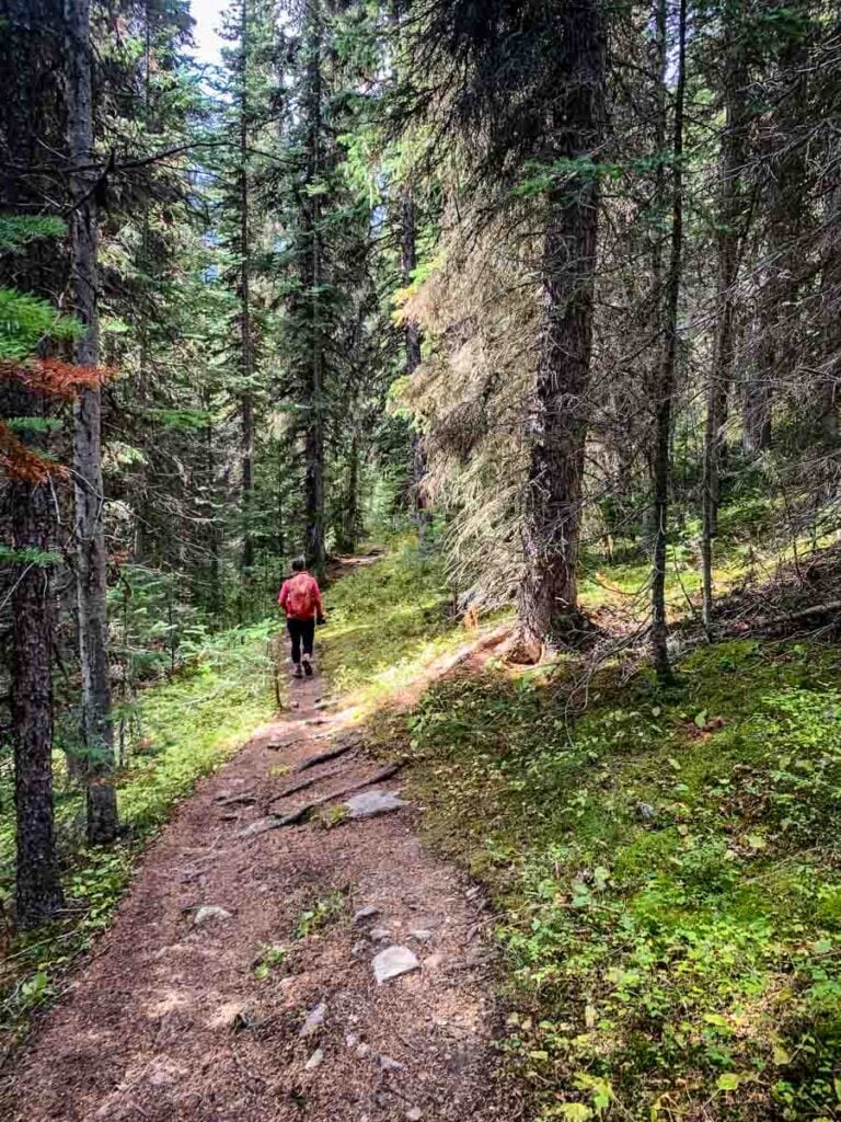
The trailhead for the Twin Lakes hike leaves from the Vista Lake parking lot off Highway 93, just before Kootenay National Park. The first 1.2 km of the Twin Lakes trail descends into the Altrude Creek valley towards Vista Lake. Along the way, you’ll enjoy the first of many nice views of Storm Mountain (3,100 m), coupled with the evergreen forest in the valley below.

When the sun is shining, gazing out over the submerged rocks and tree trunks through the crystal-clear emerald green water of Vista Lake is breathtaking. In isolation, the downhill walk to Vista Lake is one of the best easy hikes in Banff National Park.

The next 3.8 km of the hike to the Twin Lakes ascends the northern slope of Storm Mountain towards the treeline, where Arnica Lake is found. Along the way, you’ll enjoy several creek crossings and many outstanding viewpoints, where you’ll enjoy unimpeded views of Mt. Whymper (2,845 m), Boom Mountain (2,760 m) and Castle Mountain (2,766 m).
If you are enjoying the Twin Lakes hike (via Arnica Lake) in larch season, you enjoy a beautiful display of golden larch trees. The larch trees start appearing after 3.2 km of hiking and last until well beyond Arnica Lake. If you are looking for a great Banff larch tree hike without the crowds you’ll find on the Larch Valley trail, the hike to the Twin Lakes (via Arnica Lake) is a great choice!

The Twin Lakes hike reaches the shores of Arnica Lake at the 5 km mark. With the towering rocky cliffs of Storm Mountain looming high overhead, the setting for Arnica Lake is quite stunning. In larch season, the shores of Arnica Lake are lined with golden larch trees, making an already beautiful scene that much better and solidifying Arnica Lake’s spot as one of Banff’s best larch hikes.

Follow the hiking trail along the shore of Arnica Lake to enjoy the various viewpoints of this amazing Banff lake, before beginning the final leg of the hike to the Twin Lakes.
As you hike beyond Arnica Lake, the hiking trail becomes known as the Upper Twin Lake Trail. The Upper Twin Lake trail begins with a short ascent up a small ridge on the northeast side of Storm Mountain. The ascent adds approximately 100 m of elevation gain to your hike.
This initial section of the Upper Twin Lake trail gets very muddy as a pesky little creek has decided to run right through it. Be sure to wear waterproof hiking boots which you don’t mind getting wet and muddy!

At the beginning, the larch trees are about 50 feet away on the righthand side, but the larch trees meet the Upper Twin Lake hiking trail about halfway up the ridge. There are some really beautiful old larch trees along this section of trail.

5.8 km after leaving the Vista Lakes parking lot, you’ll reach the top of the ridge. You’ll be in a dense patch of larch trees, which is very pretty in fall, but the real treat is the view you’ll get of a huge larch forest appears in the distance. The two mountains you see in the distance to the east are the Pharoah Peaks (2,711 m) and the Monarch Ramparts (2,393 m).

After 4.5 km of nearly non-stop uphill hiking from Vista Lake, you’ll now start enjoying a wonderful descent down to the Twin Lakes. It doesn’t take long for the larch trees to disappear on this side of the ridge, but they are replaced with a beautiful conifer forest, with a lush carpet of green moss.

You may find it hard to believe that after 6 km of hiking, you’ll still be enjoying amazing views of Storm Mountain overhead. Storm Mountain is a massive mountain and the hike through Vista Lake, to Arnica Lake to the Twin Lakes is one of the best ways to appreciate the size and beauty of this enormous Canadian Rocky Mountain.
At the 6.9 km mark of the Twin Lakes hike, you’ll get your first glimpse of Upper Twin Lake. Listen carefully and you may be lucky enough to hear a woodpecker, as we did.
The hiking trail leads to a large, grassy meadow which leads to the shores of Upper Twin Lake. This is yet another stunning Banff lake lined with evergreen trees (with even a few larches) and a towering rocky mountain peak standing guard behind the water.

To continue on to the Lower Twin Lake trail, you’ll need to walk through the marshy, grassy meadow along the shoreline of the Upper Twin Lake creek. You’ll cross this creek on a long series of stepping stones. These big, stable rocks are one of the nicest rock bridges I’ve seen anywhere in Banff. Good job to whoever built these steps!

The Lower Twin Lake trail begins on the far side of the creek. Before long you’ll be passing through the Twin Lakes Campground (TW7) through a beautiful forest. If you are interested in backcountry camping at the Twin Lakes (TW7) campground, be sure to make your reservations in advance with the Parks Canada reservation service.
Shortly after leaving the TW7 Banff backcountry campground, the Lower Twin Lake hiking trail starts to descend through a magical mossy forest with lots of shrubs. The trees start to clear after 500 m of hiking along the Lower Twin Lake trail and you’ll enjoy even more views of Storm Mountain overhead.
As you near the Lower Twin Lake creek (around 8 km), you’ll need to contend with a significant amount of tree roots and rocks along the very muddy hiking trail. The trail junction for the North Approach to the Twin Lakes is on the left, just before the creek.
After crossing the creek on a long bridge made from large wooden posts, you’ll see the trail junction sign for the Gibbon Pass Trail (which ultimately goes on to Sunshine Village as described above). Go straight for the Gibbon Pass Trail or turn right to follow the creek to the Lower Twin Lake.

Try to enjoy the views of Storm Mountain overhead (with a few golden larch trees in the fall) as you try to navigate the extremely muddy hiking trail to the Lower Twin Lake. You’ll be hopping from rock-to-rock trying to keep your hiking boots from getting middy, but chances are good that after a while, your boots will get so muddy you’ll just give up and walk through the mud.

Your highly enjoyable Banff hike past Vista Lake and Arnica Lake reaches the Twin Lakes after 8.3 km of hiking. The Lower Twin Lake is your fourth Banff lake of the day and is every bit as beautiful and rewarding as the first three. The rocky cliffs of Storm Mountain continue to provide the backdrop for this beautiful Banff lake.

If you stop at the Lower Twin Lake for a break or for lunch, please don’t feed the beautiful, but very food aggressive Canada Jay birds (also known as Whiskey Jack or Grey Jay).
Twin Lakes Trailhead
The Twin Lakes trailhead is found in the Vista Lake Day Use Area along Highway 93 South. The Vista Lake Day Use is under 30 minutes from Banff and an hour and 50 minutes from Calgary.
To reach the Vista Lake Day Use, take the TransCanada Highway 1 west to the Highway 93 exit. Turn left at the exit and continue up Highway 93 South for 8 km then turn right into the Vista Lake parking lot at the sign. The Vista Lake day use area is just a minute or so past the Boom Lake day use area.

Twin Lakes Hike Stats
How Long is the Twin Lakes Hike?
The round-trip distance of the Twin Lakes trail is 16.6 km (for a one-way distance of 8.3 km) from the trailhead, past Vista Lake and Arnica Lake, through the Storm Mountain forest until you reach the shores of the Twin Lakes.

How Hard is the Hike to the Twin Lakes?
Primarily due to the distance and the amount of elevation gain, we rate the Twin Lakes hike as “difficult”.
Rating a hike is difficult, as everyone has different physical abilities. A hike can even feel different from one day to the next. When we start reaching distances of 15 km+ with over 1,000 m of elevation gain, it may be too difficult for some Banff hikers, but it may be more of a moderate hike for many.

Although the popular AllTrails hiking app rates this Banff hike a “moderate” hike, we agree with Parks Canada’s rating of the Twin Lakes hike as “difficult”.
By itself, we rated the hike to Arnica Lake as “moderate”, but adding the hike to the Twin Lakes adds an additional 7.3 km of distance and 413 m of elevation gain. In our opinion, this is enough to bump up the Twin Lakes trail to be a difficult Banff hike.
Yes, the Twin Lakes trail will be a moderate hike for many, but we feel that most regular Banff hikers will find the Twin Lakes trail to be challenging.
How Long Does the Twin Lakes Hike Take?
It should take a typical adult around 5 – 7 hours to hike to the Twin Lakes and back. We recently did the Twin Lakes hike during larch season and it only took us 4 hours and 40 minutes – including time to admire Vista Lake and take tons of pictures of the larch trees around Arnica Lake.

Twin Lakes Trail Map
The Twin Lakes trail is easy to follow and is well marked with Parks Canada trail signs. If you are feeling uncertain, you can use the AllTrails app while hiking to the Twin Lakes, but the hiking trail is easy enough to follow.
To find the Twin Lakes trail map in AllTrails, simply click here for the “Twin Lakes via Gibbon Pass Trail”. Be sure to download your hiking maps prior to leaving as you can’t count on having a cell signal in this remote corner of Banff National Park.
A recent App of the Year winner, AllTrails is also one of the best apps for visiting Banff! Enjoy map downloads and many more premium features with a 7-day free trial of AllTrails+!

Hiking Twin Lakes Trail with Kids
If you are visiting Banff with kids, you may find the long and steep Twin Lakes trail to be too hard for younger kids. If you are interested in this hike for your family, why not try hiking to Arnica Lake with your kids and see how you feel once you get there. If you feel up to it, your family can always continue hiking from Arnica Lake to the Twin Lakes.
We have not yet hiked the Arnica Lake with our kids, who are 8 and 6 years old, but based on hikes of comparable difficulty (like the Taylor Lake trail, Sentinel Pass or the Wind Ridge hike) we know that they could do it.

Read More
Don’t miss these other best Banff day-hikes with kids.
Where to Stop for Lunch or a Break
The obvious place to stop for lunch is at one of the beautiful Banff lakes along this hike.
With the majestic rocky cliffs of Storm Mountain providing the backdrop, Arnica Lake is a place where you’ll want to stop and take it all in.

While Arnica Lake is a very scenic Banff lake, we prefer to hike to the end of the hiking trail to have a break. In this instance, that means hiking all the way to the Lower Twin Lake before stopping to have lunch.

No matter which of the four Banff lakes you stop at, you’ll enjoy amazing views!
Twin Lakes Hiking Safety
There are relatively few hiking hazards along the Twin Lakes hiking trail.
The trail is well maintained and easy to follow from the trailhead to Vista Lake, while the trail to Arnica Lake has a moderate amount of rocks and roots. The rocks and roots remain on the final leg to the Upper and Lower Twin Lakes, and you’ll also encounter a fair amount of muddy sections.

Wildlife Safety
When hiking in Banff National Park, you are responsible for your own safety. Before hitting the hiking trails, we highly recommend you read our Essential Banff Hiking Tips for information about bear safety, trail conditions, wildlife warnings and possible closures.

Twin Lakes Trail Logistics
On-leash dogs are allowed on the Twin Lakes hike.
Mountain biking is not allowed on the Twin Lakes trail.
There are toilets no toilets in the Vista Lake parking lot. If you’d like to go prior to beginning your hike to the Twin Lakes, stop at the trailhead for the Boom Lake hike on the way. It’s only a 1 minute drive from Boom Lake to the Vista Lake parking lot.
Plan to pack plenty of water and high energy snacks for this hike. Fill your hydration packs before you leave.
You might get 1 bar of cell service on the higher elevations of the Twin Lakes hike, but 1 bar cannot be counted upon for anything useful. Don’t count on having a cell signal for your safety.

What to Bring for Hiking the Twin Lakes Trail
The Twin Lakes Trail trail is a long Banff day-hike, so you need to be properly prepared for a day of safe hiking in the mountains. Before hitting the trail, please take the time to review our recommended Banff hiking equipment.

The Twin Lakes hike offers outstanding views of Storm Mountain and the Bow Valley, with visits to four beautiful Banff lakes along the way. There’s even golden larch trees around Arnica Lake in fall!
Support Human Created Content

Hi, we’re Dan & Celine Brewer, locals from just outside Banff National Park. Every article, itinerary, and recommendation we share is rooted in our real experiences and love for this place. If you’ve found our content helpful, please consider supporting us:
- Make a small donation: Your support directly fuels our work and keeps our stories genuine.
- Purchase a guide or itinerary: Essential tools that help plan your trip and support local creators at the same time.
- Book lodging or tours through our affiliate links: You pay the same price, but we earn a small commission that helps us keep producing content.
Thank you for valuing authentic, human-created content. Your support allows us to help even more Banff travellers!
Love our content? Sharing our post is the easiest way to support us!


Dan Brewer, a life-long Alberta resident, calls Canmore home along with his wife and two kids. He is the co-owner of Travel Banff Canada, where he gets to share his passion for the Canadian Rocky Mountains. Dan, along with his family, love being outdoors doing one of the many activities they enjoy in the mountains: hiking, mountain biking, paddleboarding, skiing, snowshoeing and cross-country skiing.
When he's not in Canmore enjoying one of his favourite local hikes, you can find him hopping on a plane to explore a new country with his family or working on one of their other two travel sites: Family Can Travel and Baby Can Travel.