The Wind Ridge Trail is one of my favorite hikes in Kananaskis Country. It’s a bit of a grind to get to the top, but the views of Mt. Lougheed you get from the alpine meadow are simply incredible.
Overlooking the TransCanada highway just south of Dead Man’s Flats, Mt. Lougheed doesn’t get much attention, but it’s one of the most beautiful mountains in the Canadian Rockies. The word “majestic’ is thrown around a lot when you talk about mountains, but ‘majestic’ is the only word which describes Mt. Lougheed.

With a stately head and shoulders formation, Mount Lougheed always seems to remind me of the Lincoln Memorial in Washington D.C. Weird right? Let’s see what you think…

This post contains compensated links.
Wind Ridge Trail Highlights
The Wind Ridge Trail is a spectacular and very rewarding Kananaskis hike just south of Dead Man’s Flats. The Wind Ridge hike is difficult and not for everyone, but if it’s within your physical capabilities, chances are good that you’ll love it. I think it’s one of the best hikes in Kananaskis (or anywhere in the Canadian Rockies for that matter).

The Wind Ridge hike consists of two main sections – each an entirely different experience:
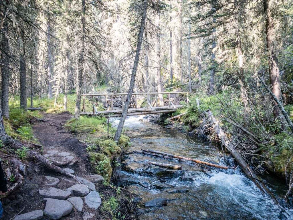
The first 4km of the Wind Ridge hike is an easy stroll through a thick, lush forest with a carpet of moss and Old Man Beard lichen swinging from tree branches. The sounds of squirrels and birds will keep you company as you admire the wild roses, shooting stars and Indian paintbrushes which grow profusely along the side of the trail.
While in the forest, the Wind Ridge trail crosses Pigeon Creek, Wind Creek and West Wind Creek. River crossings in the midst of a Rocky Mountain forest always inspire me to pause and soak in the scenery.

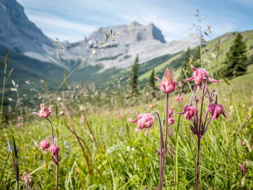
At the 4km mark, the forest starts to mingle with the alpine meadow. Wildflowers grow prolifically in the open meadows, attracting lots of butterflies. Look behind you for some of your first elevated glimpses of Mt. Lougheed – just a small taste of what’s to come.

You’ll leave the forest behind at the 5km mark of the Wind Ridge hike and enter the alpine meadow. You’ll be walking west with unimpeded views of a semi-circle of beautiful mountains including The Rimwall, Wind Tower, Mount Lougheed and Wind Mountain. This is one of the most scenic views you can earn hiking in Alberta.


As if the mountain views weren’t enough, the south-facing alpine meadow on Wind Ridge is home to thousands (probably millions) of alpine wildflowers of every color imaginable.
Amazingly enough, due to the cooler temperatures at the higher altitude we even found crocuses in bloom at the top of Wind Ridge in mid-July (a flower which typically blooms in Alberta in March-April).

The Wind Ridge hike through the alpine meadow is very steep, but the views from the top are totally worth it. One you reach the top of Wind Ridge, you’ll have earned views of the other side of the ridge, including excellent views stretching from the Alberta prairies all the way to Cascade Mountain in Banff National Park.

In between these two points, you’ll love the views of the Bow River meandering through the Bow Valley mountains, Canmore and Dead Man’s Flats. Finally, it’s a great opportunity to see the famous Three Sisters from behind.

Hiking Wind Ridge Trail in Winter
The Wind Ridge trail is closed every year from December 1 to June 15 to protect critical winter range habitat for elk and bighorn sheep. Not to worry, there are plenty of excellent winter hikes around Canmore you can enjoy.
More info on the Wind Ridge winter closure.

Wind Ridge Hike Stats
Distance: The round-trip distance of the Wind Ridge hike is 12.7km (one-way distance of 6.35km).
Elevation Gain: The total elevation gain you’ll encounter along the Wind Ridge hike is 950m.

Difficulty: The first 4km of the Wind Ridge hike is pretty easy with a net elevation gain of approximately 230m. Take the time to savor the easy stroll through the forest as it’s about to become much harder.
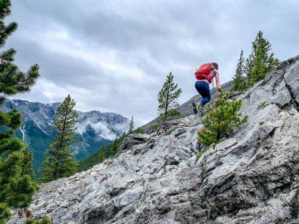
In the final 2.3km to the top of Wind Ridge, you’ll gain approximately 620m of net elevation. It’s a short, but very steep section with some very slippery gravel trail conditions to navigate. You’ll also encounter a small rock climb (which you can avoid by going around and do a short rock scramble). Most people (including me) feel the rock climb is the easier option.

Based on the very steep section to the top, we rate the Wind Ridge hike as “difficult”.
Duration: It should take a typical adult about 5.5 hours to complete the full round-trip distance of the Wind Ridge hike.
Wind Ridge Trail Location
How to Get from Banff to the Wind Ridge Trail: The Wind Ridge hike is located just south of Dead Man’s Flats on George Biggy Sr. Road.
The fastest way to get to the Wind Ridge hike from Banff is to go east on the TransCanada Highway and turn south at Dead Man’s Flats onto George Biggy Sr. Road.

Note, despite most locals calling this hike Wind Ridge, Alberta Parks refers to this Kananaskis hike as “Windy Viewpoint”. You may also hear it called the “Windy Ridge hike”.
Kananaskis Hiking Trails Maps
It used to be easy to get lost in the forest on the Wind Ridge hike, but recently Alberta Parks has done an excellent job installing trail maps at all the main junctions along the Wind Ridge trail. You can probably navigate the full length of the Wind Ridge hike with these trail maps, but we recommend having an electronic or paper back-up just in case.
We use the AllTrails app every time we go hiking in Kananaskis, Banff and around the world. It helps us stay on track and track our stats (distance, elevation gain, etc). You’ll find this hike in AllTrails by clicking this links for the “Wind Ridge Trail Map“

Hiking Wind Ridge with Kids
Our kids have grown up in the Canadian Rocky Mountains and at age (nearly) 5 & 7 are very capable little hikers. We recently hiked the full length of Wind Ridge with our kids – making it their longest and hardest day hike to date.

That said, Wind Ridge is a difficult hike and may not be suitable for some kids. Ours were definitely the youngest kids found on the Wind Ridge trail that day.
Before attempting the Wind Ridge hike with kids, we recommend:
Looking at the Wind Ridge hike stats above and making sure your kids are capable of such physical exertion. During the steep part, you’ll be gaining over 270m of elevation for every 1km hiked towards the top of Wind Ridge – that’s an average 27% incline. Imagine climbing the height of 1.5 Calgary Tower’s for every kilometer you walk…
Gauging their adventurousness. There are a few sections along this hike which may intimidate some hikers – both kids and adults alike. There is a small rock climb or scramble to deal with and the steep sections can be very slippery, especially going down. Kids who get scared in risky situations may not enjoy this hike.

Including breaks, it took us 7.5 hours to hike the full length of the Wind Ridge trail with our kids – about 2 hours longer than for adults hiking Wind Ridge without kids.
Where to Stop for Lunch or a Break
There are three spots along the Wind Ridge trail which are great spots to stop for a break or lunch.
After 4km of hiking through the forest, you’ll emerge from the trees and enter an incredible alpine meadow featuring millions of beautiful alpine wildflowers. The views of majestic Mt. Lougheed are truly breathtaking from here.
Your first really steep stretch of the Wind Ridge trail comes after entering the alpine meadow. Near the top of this stretch is a reasonably flat patch of meadow where you can stop, rest and soak in the incredible Canadian Rocky Mountain scenery.

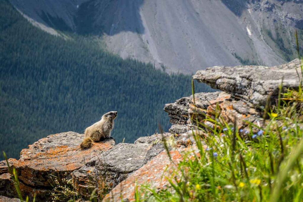
A little further up the Wind Ridge trail, the alpine meadow becomes rockier (requiring a small rock climb or scramble). Large rocks covered with beautiful red lichen jut out of the southern slope of Wind Ridge.
These rocks are about half-way through the difficult upper section of the Wind Ridge hike, making it a great place to plop down on your picnic blanket and have a well-deserved rest.

The rocks are home to a colony of Hoary Marmots – please do your part to keep them wild by not feeding them.

The other spot we recommend stopping is, of course, the flat, treeless clearing at the top of the Wind Ridge hike. The incredible views from the top include Mt. Lougheed and a rare view of the back of the Three Sisters.
The Wind Ridge hike is very close to Canmore, so you could reward yourself after this difficult hike with an ice cream in Canmore or a great meal at one of Canmore’s many excellent restaurants.
Wind Ridge Hiking Safety
Hiking Kananaskis comes with bear risk. We love bears and would hate for any harm to come to them or you, so please take the time to educate yourself on how to be bear smart.
The Wind Ridge hike is popular with dog owners. We recommend bringing your dog only if they are athletic enough to deal with the steep slopes and the rock scrambles.
Although you will likely see lots of people with off-leash dogs, please keep your dog on leash. Besides being the law, an off-leash dog can very easily draw a bear or cougar back to your group.
This happens far too often and puts your life and the life of the animal in danger. Here’s a recent example of a person who was lucky to walk away from a grizzly attack at Grotto Mountain (a stone’s throw from Wind Ridge).

We recommend checking the latest Wind Ridge trail report to check trail conditions and possible closures before you head out. (Keep in mind Alberta Parks calls this hike Windy Viewpoint).
Wildlife Safety
When hiking in Kananaskis Country, you are responsible for your own safety. Before hitting the hiking trails we highly recommend you read our 9 Essential Kananaskis Hiking Tips for information about bear safety, trail conditions, wildlife warnings and possible closures.
Wind Ridge Trail Logistics
There are washrooms in the Wind Ridge Trail parking lot. There are no toilets on the trail, so make sure everyone goes before they begin.
There are no drinking water facilities, so fill your hydration packs before you leave.
With several popular Kananaskis hikes and mountain biking routes in the area, the parking lot fills up early in the day. When full, cars overflow to parking along George Biggy Sr. Road.
At best, you may get spotty cell phone service while hiking Wind Ridge. We got a weak signal in a few spots within the alpine meadow, but that’s it. Don’t count on having any cell service just in case…
If you’re looking for a cozy cottage in the Rocky Mountains, the Banff Gate Mountain Resort is steps away from the Wind Ridge Trailhead. Despite its somewhat misleading name (it’s a 17 minute drive to the Banff National Park entrance gate), it gets good reviews on Google and Booking.com.

What to Bring While Hiking Wind Ridge
Wind Ridge is a difficult Kananaskis day-hike, so you need to ensure you are prepared for a safe day of hiking in Kananaskis. Before hitting the trails, be sure to review our list of Kananaskis hiking gear essentials to ensure you have a safe & fun day of hiking the Wind Ridge Trail.
Local Tip
The forest can get quite marshy around the multiple creek crossings and the mosquitos can occasionally be quite fierce. Bring insect repellent.


Please Support Human Created Content
This post was written by a local who lives just minutes outside Banff National Park. If this post was helpful, and you value getting accurate Banff advice from a real human (not AI), please click here to make a small donation or explore other easy ways support our small business. Every bit makes a difference.
Additional Challenging Kananaskis Hikes
Found this post useful? Save it or share it with your friends!

Dan Brewer, a life-long Alberta resident, calls Canmore home along with his wife and two kids. He is the co-owner of Travel Banff Canada, where he gets to share his passion for the Canadian Rocky Mountains. Dan, along with his family, love being outdoors doing one of the many activities they enjoy in the mountains: hiking, mountain biking, paddleboarding, skiing, snowshoeing and cross-country skiing.
When he's not in Canmore enjoying one of his favourite local hikes, you can find him hoping on a plane to explore a new country with his family or working on one of their other two travel sites: Family Can Travel and Baby Can Travel.


