The Ha Ling Peak hike is a popular day hike with Canmore and Banff locals. It’s a short, but very steep slog up the north-western slope of Ha Ling Peak, a dramatic mountain nestled just minutes outside the Town of Canmore.
Ha Ling Peak’s huge 300 m towering vertical cliff face makes it one of the most recognizable mountains in Canmore. I love admiring the unique shape of Ha Ling from down below in the Bow Valley, knowing I’ve stood at the very top. The great workout and excellent rewards that go along with hiking the Ha Ling trail makes it one of my favorite hikes near Canmore.

This post contains compensated links.
Ha Ling Trail Highlights
If you love Canadian Rocky Mountain scenery, the Ha Ling Peak trail is a very rewarding hike. It’s a difficult hike and is not for everyone, but if it’s within your physical capabilities, chances are good that you’ll love it. The Ha Ling Peak trail is one of the best hikes in Canmore.

The first section of the Ha Ling hike crosses a channel for a hydro-electric dam. The water in the channel can be glass-smooth in the morning, providing amazing mountain reflections. Before long, the Ha Ling hike enters a dense forest with lichen dancing in the wind from evergreen trees above a carpet of green moss.

After 2.5 km of non-stop uphill hiking, you’ll be treated to a great place to rest. Here you’ll find a short trail with safety ropes to a lookout, where you will enjoy views of Mount Rundle, Mount Lady MacDonald, Goat Creek and parts of Canmore. As amazing as these views are, they are just a small taste of what is to come further up the Ha Ling Peak trail.

At 3.4 km, get ready for a glute workout! You’ll encounter three sets of newly constructed wooden staircases which take you straight up the steep upper slopes of Ha Ling Peak. Anyone who hiked the Ha Ling trail prior to the trail upgrades will appreciate what an improvement this is over the steep, slippery switchbacks which used to occupy this section of trail.

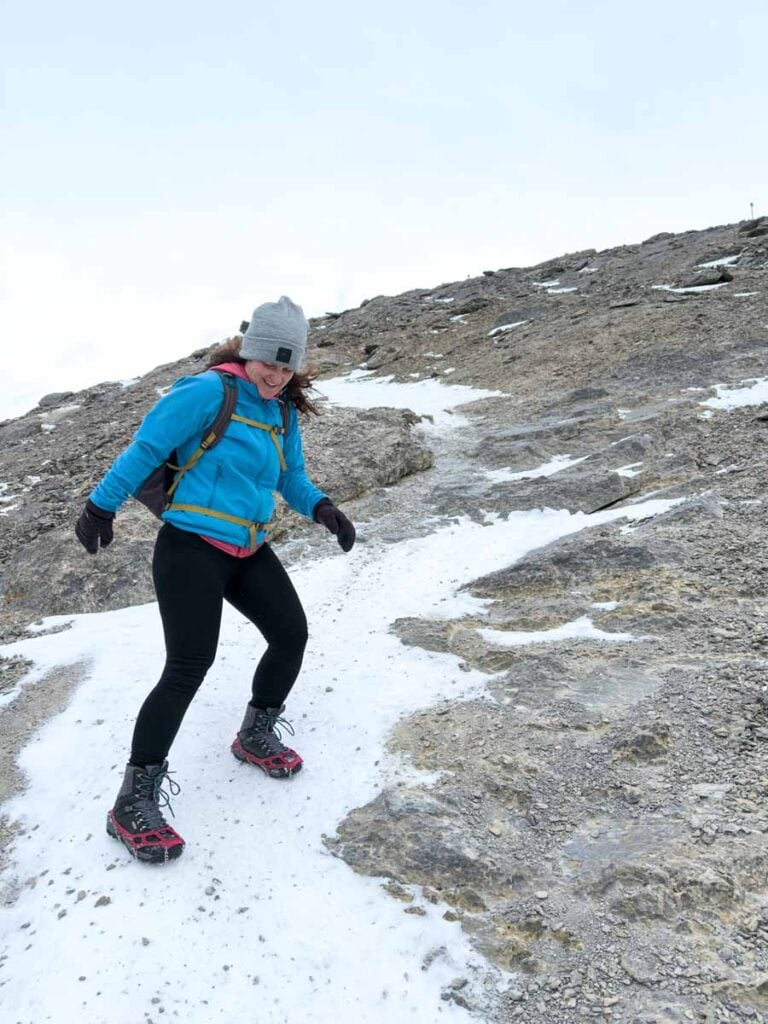
At 3.7 km the upgraded trail ends, and the Ha Ling trail is no longer officially maintained. The hiking trail surface becomes angled rock and loose scree, which is a bit of a shock to the system after the wonderfully manicured hiking trail to this point.
At 3.8 km you reach “The Saddle” (see the red arrow in the image below). You are not yet at the top of Ha Ling Peak, but the Saddle is the first point where you can see over the upper ridge to see the views on the other side of the mountain. From the Saddle, you can choose to go left to the summit of Ha Ling Peak, or right to the less popular Miners Peak trail (a great alternative to avoid the crowds),

The final 300 m of the Ha Ling Peak hike involves choosing your own path through a field of scree and small boulders. There are multiple trails to the top of Ha Ling, so pick a line a go with it. Stop every now and then to look for main arteries, which can be a bit safer to follow.
The 360-degree views from the top of Ha Ling Peak are breathtaking. To the north you can see from Mount Lady MacDonald all the way down the Bow Valley to Exshaw. In-between, you’ll see Quarry Lake (Canmore’s favorite swimming hole) and the Rundle Forebay Reservoir (great for SUP and kayaking!).

Behind you, you’ll enjoy views spanning from Goat Creek all the way to the Spray Lakes. To your right, Miners Peak proudly juts out over Canmore, while to the left you’ll have an up-close look at the south summit of Mount Rundle, home to the East End of Rundle hike (EEOR) – another of our favorite difficult Canmore hikes.

The wispy clouds we get in the morning near Canmore produces some incredible sunrises. Not surprisingly, Ha Ling Peak is a popular sunrise hike in Canmore. The Ha Ling trail is also popular with trail runners, especially in the morning.
Read More
We like the Ha Ling Peak Trail so much, we included it in our 7 Day Banff Itinerary for Hikers.
Ha Ling Trail Upgrades
The beautiful forest will capture your attention but take a moment to notice the excellent condition of the Ha Ling hiking trail, which went through significant upgrades in 2019.
Upgrades to the Ha Ling trail include:
- Thoughtfully located benches with amazing views.
- A well-groomed hiking trail up Ha Ling Peak with most roots and rocks removed.

- Safety chains have been added where appropriate.
- Smooth stone steps have been added to the Ha Ling trail.

Footsteps have been chiseled in rocks.
- Three long wooden staircases have replaced the old, steep switchbacks near the top of Ha Ling.

These trail upgrades by Alberta Parks not only make your journey to the top of Ha Ling Peak more enjoyable, but they help control erosion and protect the endangered Whitebark Pine trees which grow on these slopes.

Ha Ling Peak Hike Stats
How Long is the Ha Ling Peak Trail?
The round-trip distance of the Ha Ling trail is 8.0 km (one-way distance of 4.0 km).
How Steep is the Ha Ling hike?
The total elevation gain you’ll encounter along the Ha Ling Peak hike is 801 m (for an average of 200m elevation gain per 1 km). The trail starts at 1,660 m above sea level and the Ha Ling Peak elevation at the summit is 2,408 m.
How Hard is the Ha Ling Peak hike?
The hike up Ha Ling Peak starts uphill and it never lets up. It’s a short, very steep hike but the trail is in amazing condition.
The Ha Ling trail is mostly well-groomed with no big rocks or tree roots to contend with. Once you reach the end of the maintained trail at “The Saddle”, it becomes a challenging rock scramble, with loose rocks and small boulders all the way to the Ha Ling summit. There is no rock climbing on this route though.
We rate the Ha Ling Peak trail as “difficult”.

Ha Ling Peak Hike Duration
It should take a typical adult about 3 hours to hike the full round-trip distance of the Ha Ling hike.
Ha Ling Trail Directions
Despite its status as one of the best hikes near Canmore, the Ha Ling Peak hike does not have its own parking lot. The nearest parking lot to the Ha Ling trailhead is across the Smith-Dorrien Highway in the Goat Creek parking lot.
It’s an 80 minute drive from central Calgary to the Ha Ling Peak hike. Or, it’s about half the time to drive from Banff to Ha Ling.
Kananaskis Conservation Pass
As the Goat Creek parking lot is in Kananaskis Country, everyone who parks there will need a Kananaskis Conservation Pass. You can buy a day pass or an annual pass, either online or by phone.
Ha Ling Peak – Canmore & Kananaskis Hiking Maps
The newly upgraded Ha Ling hiking trail is well-marked and incredibly easy to follow. Between the abundant signage and the crowds, it would take real effort to get lost while hiking Ha Ling Peak.

Once you reach the Saddle, the trail is no longer maintained and there are several scramble routes to the summit of Ha Ling Peak, but you are so close to the top that it’s impossible to get lost if you simply keep going up.
We used the AllTrails app while hiking to the Ha Ling Peak summit, but to be honest, we didn’t need it for navigation purposes. We use AllTrails for all our hiking and biking in the Canadian Rockies and around the world. In addition to helping stay on the trails, we like the ability to track our hiking stats (distance, elevation gain, etc.).

To find the Ha Ling Peak trail map in AllTrails, simply click here for the “Ha Ling Trail to Ha Ling Peak”. You are close enough to Canmore that you should get intermittent cell service while hiking Ha Ling Peak, but just to be safe, be sure to download your hiking maps prior to leaving.
A recent App of the Year winner, AllTrails is also one of the best apps for visiting Banff! Enjoy map downloads and many more premium features with a 7-day free trial of AllTrails+!
Hiking Ha Ling Peak Trail with Kids
Our kids have grown up in the Canadian Rocky Mountains and at age 5 & 7 are very capable little hikers. Highlights of their resume include Wind Ridge (one of our favorite Kananaskis hikes) and the Lost City in Colombia.
We haven’t attempted hiking Ha Ling Peak with our kids yet, but given they accomplished Wind Ridge, I expect they could also do the Ha Ling hike (with enough time and patience, of course).
Tons of super cute squirrels and chipmunks call Ha Ling Peak home. They are experts at looking cute, yet desperately starving in hopes of getting a human food reward. Please do the right thing and not feed them – a fed animal is a dead animal.

Before attempting the Ha Ling Peak hike with kids, we recommend:
Looking at the Ha Ling hike stats above and making sure your kids are capable of such physical exertion. You’ll be gaining 200 m of elevation for every 1 km hiked towards the top of the Ha Ling Peak hiking trail. This is a steady 20% incline – it’s not easy…
Even more important than their physical capability, assess your kids listening & obedience levels. The final push towards the summit of Ha Ling Peak is a tricky rock scramble, and once at the summit, a fall down the cliff would be fatal. Kids who do not listen and cannot follow directions to the letter should not hike beyond the Saddle.

Where to Stop for Lunch or a Break
Another nice benefit of the recent Ha Ling trail upgrades was the addition of many benches along the trail. These benches are all strategically placed to enjoy scenic views of Mount Rundle, the Spray Valley and beyond.
The benches are nice, but the best spots to stop for lunch on the Ha Ling Peak trail are the Saddle and the summit. Both locations enjoy amazing views of the Bow Valley from Banff National Park all the way to Exshaw.

Everyone loves stopping at the Ha Ling summit, but it can get very crowded up there, so taking a break at the Saddle is a good alternative.
The Ha Ling trail is very close to Canmore, so you could reward yourself after this difficult hike with an ice cream in Canmore or a great meal at one of Canmore’s best lunch restaurants.
Ha Ling Hiking Safety
The newly restored hiking trail to the Ha Ling Saddle should be reasonably safe for those with proper hiking footwear. The short rock scramble from the Saddle to the Ha Ling Peak gets a little more difficult and perhaps scary for some.
Take careful steps through the scree and always ask yourself what will happen if you slip on the next step. If it’s not safe, backtrack and try a different route.

Once at the summit of Ha Ling Peak beware the potential for a 300+ meter fall down the dramatic cliff on the north side of the mountain (see below). There are no safety rails preventing a fall.
There have been multiple Ha Ling Peak deaths from a variety of activities: rock climbing, paragliding, wingsuits and even hiking. I have witnessed people teetering on the edge of the Ha Ling Peak cliff doing the King Dancer yoga pose for an Instagram shot. Please don’t – we don’t need any more fatalities.

Watch for “Avalanche Zone” signs while hiking Ha Ling Peak – stopping in these areas is not recommended.
When scrambling to the summit, keep a safe distance from each other as rocks may come loose and fall on those hiking below.
Resist the urge to throw rocks over the edge of the summit of Ha Ling Peak. The 300 m straight vertical cliff is popular with mountain climbers and thrown rocks are a significant danger to them.
We recommend checking the latest Ha Ling trail report for trail conditions and possible closures before you head out.

Wildlife Safety
When hiking in Kananaskis Country, you are responsible for your own safety. Before hitting the hiking trails, we highly recommend reading our Essential Kananaskis Hiking Tips for information about bear safety, trail conditions, wildlife warnings and possible closures.
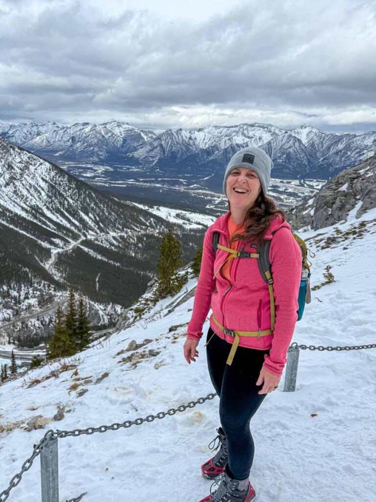
Hiking Ha Ling Peak in Winter
The hike up Ha Ling Peak is a popular year-round Canmore activity, even in wintertime. The views you will enjoy along the way up are magical, as all the surrounding Rocky Mountain peaks and the evergreen forests below will be covered with snow.
A few things you should know about hiking Ha Ling Peak in Winter:
Due to the popularity of this winter hike near Canmore, the trail will often be hard packed snow, and sometimes icy. This makes hiking with effective winter traction gear a must. Celine and I used our Kahtoola MICROspikes and found that they were the perfect tool for the job with more than adequate grip on the snowy trail. There were several people attempting this hike without microspikes and they looked like they were hating life.
It seems like sliding on your bum on the snow through the trees has become a popular thing to do on Ha Ling in winter. While this may look fun, please don’t. Alberta Parks just invested significant money in upgrading this trail to reduce erosion and protect the endangered Whitebark pine trees.
By creating bum luge tracks in winter, you will be creating unnatural water flows and increasing erosion when the snow melts. Please help protect this fragile environment and take your sledding elsewhere.
Ha Ling Hike Logistics
On-leash dogs are allowed on the Ha Ling trail.
Mountain biking is not allowed.
There are several washrooms in Goat Creek parking lot. There are no toilets on the Ha Ling trail and the trail is quite popular making it harder to duck into the trees to water the flowers. It’s best if everyone goes before they begin.
There are no drinking water facilities on Ha Ling Peak, so fill your hydration packs before you leave.
With many popular hikes and mountain biking routes, the Goat Creek area is very popular and the parking lot fills up early in the day. To avoid a full parking lot, try to hike Ha Ling Peak early in the day on a weekday if possible.
Being so close to Canmore, you should have cell service for most of the hike, but never count on it for your safety.

What to Bring While Hiking Ha Ling Peak
The Ha Ling Peak Trail is a challenging Kananaskis day-hike, so you need to be properly prepared for a day of safe hiking in the mountains. Before hitting the trail, please take the time to review our recommended Kananaskis hiking gear.

Even in summer, it can be cold near the top of the Ha Ling Peak hike. While hiking EEOR in June (the adjacent mountain with a similar elevation profile) it actually snowed on us as we arrived at the top!
We wish we’d have brought gloves as the wind was very cold at the summit and our hands got quite numb, making the descent scramble more dangerous than it needed to be. It never hurts to throw a pair of gloves into the bottom of your hiking day bag.

Read More
As you can see, it can be challenging to dress properly for hiking in the Canadian Rockies. We have lots of advice in our guide on what to wear hiking in Banff.
Support Human Created Content

Hi, we’re Dan & Celine Brewer, locals from just outside Banff National Park. Every article, itinerary, and recommendation we share is rooted in our real experiences and love for this place. If you’ve found our content helpful, please consider supporting us:
- Make a small donation: Your support directly fuels our work and keeps our stories genuine.
- Purchase a guide or itinerary: Essential tools that help plan your trip and support local creators at the same time.
- Book lodging or tours through our affiliate links: You pay the same price, but we earn a small commission that helps us keep producing content.
Thank you for valuing authentic, human-created content. Your support allows us to help even more Banff travellers!
Additional Challenging Kananaskis Hikes


Love our content? Sharing our post is the easiest way to support us!


Dan Brewer, a life-long Alberta resident, calls Canmore home along with his wife and two kids. He is the co-owner of Travel Banff Canada, where he gets to share his passion for the Canadian Rocky Mountains. Dan, along with his family, love being outdoors doing one of the many activities they enjoy in the mountains: hiking, mountain biking, paddleboarding, skiing, snowshoeing and cross-country skiing.
When he's not in Canmore enjoying one of his favourite local hikes, you can find him hopping on a plane to explore a new country with his family or working on one of their other two travel sites: Family Can Travel and Baby Can Travel.