The East End of Rundle hike is a popular day hike with Canmore and Banff locals. EEOR (pronounced “Eeyore”) is a short, but very steep slog up the eastern ridge of Mount Rundle, a huge mountain separating the 12km between the Town of Banff and Canmore.
Mt. Rundle is one of the most recognizable mountains in Banff. The beautiful view of Mount Rundle from the Vermillion Lakes is widely seen in Banff promotional material.

Its long been one of my favorite mountains in Banff (as a kid I wanted to slide down the back), so I was excited to get a chance to hike to one of its many summits. (The actual summit of Mount Rundle is closer to the Town of Banff and is yet another 400m higher).
This post contains compensated links.
East End of Rundle Hike Highlights
EEOR is a spectacular and very rewarding hike just outside of Canmore. It’s difficult and not for everyone, but if it’s within your physical capabilities, chances are good that you’ll love it. EEOR is one of the best hikes in Canmore.
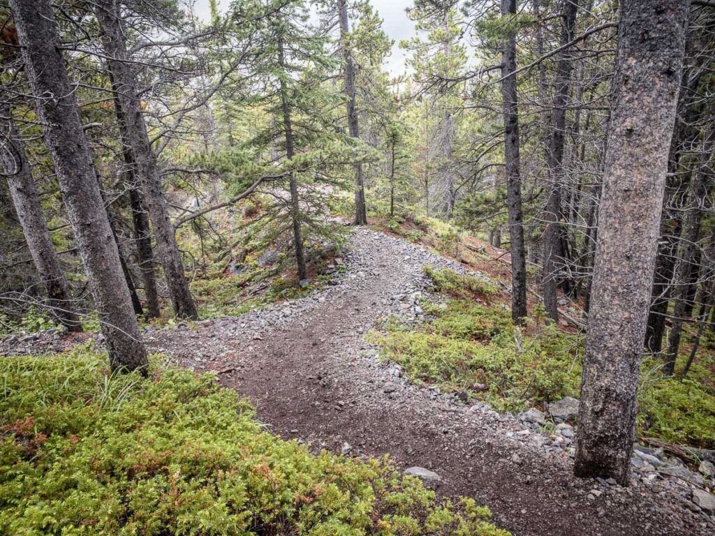
The beginning of the East End of Rundle hike is through a dense forest with a carpet of green moss. It doesn’t take long to gain enough elevation to enjoy views of Whiteman’s Pond, resting below the very impressive cliff face of Ha Ling Peak.

After 1km, you’ll be able to look back and enjoy south-facing views of the Spray Valley Provincial Park. At this stage, you’ll also start enjoying jaw-dropping glimpses of Ha Ling Peak, one of the most dramatic mountains in the area.

The higher you go, the better the views get. You’ll enjoy views of the Goat Creek Valley, the Town of Canmore, and the Spray Lakes in the distance.

I lost track of the number of times the word, “Wow!” involuntarily came out of our mouths – the views are just that good.
EEOR Hike Stats
Distance: The round-trip distance of the East End of Rundle hiking trail is 5.6km (one-way distance of 2.8km).
Elevation Gain: The elevation gain you’ll encounter along the EEOR hike is 877m (for an average of 313m elevation gain per 1km).
Difficulty: The very first step of the East End of Rundle hike is uphill and it stays that way right to the top. It’s a short, but very steep hike with difficult terrain to navigate. While hiking the unmaintained EEOR trail you’ll encounter tree roots, uneven rocks and some challenging (sometimes dangerous) rock scrambles. You’ll never really do any rock climbing though.
We rate the East End of Rundle hike as “difficult”.
Duration: It should take a typical adult about 3.5 hours to hike the full round-trip distance of the East End of Rundle hike.

East End of Rundle Trail Location
How to Get from Banff to the East End of Rundle Trail: Despite its local popularity, the EEOR trailhead is an unmarked trail from the side of the Smith-Dorrien Trail Highway in the Peter Lougheed Provincial Park part of Kananaskis Country.
EEOR does not have its own parking lot. The nearest parking lot to the EEOR trailhead is the Goat Creek parking lot. You’ll need a Kananaskis Conservation Pass to park here.


EEOR – Canmore & Kananaskis Hiking Maps
The East End of Rundle is one of those challenging, and somewhat maddening hikes where there is a seemingly endless choice of unmarked trails up-and-down the mountain. Sometimes the right path to take is labelled with a painted blue square, and sometimes the wrong trail has a fallen tree placed over it, but these are exceptions, not the rule.

We used the AllTrails app while hiking to the top of EEOR and to be honest, I couldn’t imagine doing this hike without it. Even with the app, we found ourselves well off the trail several times and the ability to see our current GPS location relative to the trail helped us navigate our way back.
We use AllTrails for all our hiking and biking in the Canadian Rockies and around the world. In addition to helping stay on the trails, we like the ability to track your stats (distance, elevation gain, etc.).
To find the EEOR map in AllTrails, simply click this link for “East End of Rundle (EEOR)”. You should get a cell signal from nearby Canmore, but just to be safe, be sure to download your hiking maps prior to leaving.
A recent App of the Year winner, AllTrails is also one of the best apps for visiting Banff! Enjoy map downloads and many more premium features with a 7-day free trial of AllTrails+!
Hiking East End of Rundle with Kids
What kid doesn’t love Winnie the Pooh? Of course they’ll want to go on the Eeyore hike! Unfortunately for your kids, Mt. Rundle is not in the Hundred Acre Woods…

Our kids have grown up in the Canadian Rocky Mountains and at age 4 & 6 are very capable little hikers. They recently hiked the Wind Ridge Trail, a very difficult hike near Canmore which, on paper, is a harder hike than EEOR. That said, there is no way I’d bring them on this Mount Rundle hike until they are much older.
Before attempting EEOR with kids, we recommend:
Looking at the EEOR hike stats above and making sure your kids are capable of such physical exertion. You’ll be gaining over 300m of elevation for every 1km hiked towards the top of Mt. Rundle. This is a steady 30% incline – it’s not easy…
Even more important than their physical capability, assess your kids listening & obedience levels. There are dangerous rock scrambles on this hike with potentially fatal consequences. Kids who do not listen and cannot follow directions to the letter should not be brought on the EEOR hike.
Where to Stop for Lunch or a Break
There are two spots along the East End of Rundle trail which are great spots to stop for lunch.
After 2km of hiking straight up, you’ll emerge from the trees and enter the alpine zone. Unimpeded by trees, the views of the surrounding Rocky Mountains are incredible, especially of the nearby Ha Ling Peak.

Approximately 0.5km after emerging from the trees, go left at the junction and you’ll hike through a spectacular alpine meadow with thousands of tiny mountain wildflowers.

This is a great spot to stop to plop down your picnic blanket and soak in the mountain views. We were lucky enough to spot a rare & elusive Mountain Goat!

The other spot we recommend stopping is, of course, the East End of Rundle summit where you will enjoy exceptional views. It can get extraordinarily windy up there, but if you descend a little, you can typically find a rock wall to shelter you from the wind.

The EEOR hike is very close to Canmore, so you could reward yourself after this difficult hike with lunch in Canmore, or an ice cream in Canmore.
East End of Rundle Hiking Safety

Hiking EEOR is a serious endeavor – there are many difficult scrambles which could be a bit difficult and scary for some. Please take this risk seriously as a woman died while hiking EEOR while descending a short scramble section.
We recommend checking the latest trail report for trail conditions and possible closures before you head out. Unfortunately, there is no official EEOR trail report, so use the Ha Ling trail report and the Goat Creek trail report as proxies for the conditions you may encounter.
Kananaskis Country is bear country. We love bears and would hate for any harm to come to them or you, so please take the time to educate yourself on how to be bear smart.
Due to the amount of scrambling involved, we recommend leaving your dog at home.
When scrambling, keep a safe distance from each other as rocks may come loose and fall on hikers below.

It’s easy to get off the EEOR trail. If you believe you are off the trail and you aren’t using AllTrails, keep in mind that EEOR is a ridge hike for most of its length.
This means you should be able to see the mountain slope downwards down on both sides of the trail more often than not. If this is not the case, try looking for a trail which takes you back up to the ridge. (But really – you should be using a hiking app like AllTrails for this hike).
For recommendations on what to bring on EEOR to improve your safety, see below.

Wildlife Safety
When hiking in Kananaskis Country, you are responsible for your own safety. Before hitting the hiking trails, we highly recommend reading our Essential Kananaskis Hiking Tips for information about bear safety, trail conditions, wildlife warnings and possible closures.
EEOR Trail Logistics
There are several washrooms in the Goat Creek parking lot. There are no toilets on the EEOR trail, so make sure everyone goes before they begin.
There are no drinking water facilities, so fill your hydration packs before you leave.

With many popular hikes and mountain biking routes, the Goat Creek area is very popular and the parking lot fills up early in the day. To avoid a full parking lot, try to visit early in the day on a weekday if possible.
Being so close to Canmore, you should have cell service for most of the hike, but never count on it for your safety.

What to Bring While Hiking East End of Rundle
As described above, EEOR is a challenging hike, so you will need to be prepared with the proper hiking gear. Before attempting this challenging Kananaskis hike, be sure to review our list of Kananaskis hiking gear to ensure you are ready for this hike.
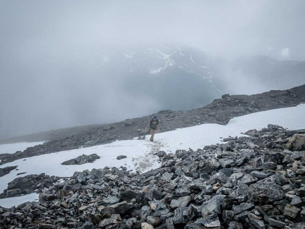
Even in summer, it can be cold near the EEOR summit. We passed several large patches of snow near the summit and it actually snowed on us as we arrived at the top. We wish we’d have brought gloves as the wind was very cold at the summit and our hands got quite numb, making the scrambling on the descent more dangerous than it needed to be.
Learn from our mistakes and read through our guide on what to wear hiking in the Canadian Rockies.


Support Human Created Content

Hi, we’re Dan & Celine Brewer, locals from just outside Banff National Park. Every article, itinerary, and recommendation we share is rooted in our real experiences and love for this place. If you’ve found our content helpful, please consider supporting us:
- Make a small donation: Your support directly fuels our work and keeps our stories genuine.
- Purchase a guide or itinerary: Essential tools that help plan your trip and support local creators at the same time.
- Book lodging or tours through our affiliate links: You pay the same price, but we earn a small commission that helps us keep producing content.
Thank you for valuing authentic, human-created content. Your support allows us to help even more Banff travellers!
Additional Challenging Kananaskis Hikes


Love our content? Sharing our post is the easiest way to support us!


Dan Brewer, a life-long Alberta resident, calls Canmore home along with his wife and two kids. He is the co-owner of Travel Banff Canada, where he gets to share his passion for the Canadian Rocky Mountains. Dan, along with his family, love being outdoors doing one of the many activities they enjoy in the mountains: hiking, mountain biking, paddleboarding, skiing, snowshoeing and cross-country skiing.
When he's not in Canmore enjoying one of his favourite local hikes, you can find him hopping on a plane to explore a new country with his family or working on one of their other two travel sites: Family Can Travel and Baby Can Travel.