Located just 22 km from the Town of Banff, the mountain resort town of Canmore, Alberta enjoys the same idyllic Rocky Mountain scenery as its more famous neighbor. As Canmore is surrounded by towering mountain peaks in all directions, you would be tempted to think that there are no easy Canmore walking trails, but that’s simply not true.
There are a remarkable number of easy Canmore walks all around town, most of which are on paved trails and have little-to-no elevation gain. These easy Canmore walking trails do not skimp on scenery though. Along these easy Canmore walks you’ll enjoy mountain views, lakes, rivers, forests and so much more.

This post contains compensated links.
15 Best Easy Canmore Walks
1. Policeman’s Creek Boardwalk
Conveniently located in downtown Canmore, the Policeman’s Creek boardwalk trail is a must-do Canmore walking trail. The Policeman’s Creek trailhead is along main street (8th Street) across from the Big Head sculpture. Be sure to stop and wait your turn for a picture with this iconic Canmore artwork before beginning this very scenic easy Canmore walk.

Only 0.5 km (0.3 mi) long, the perfectly flat Policeman’s Creek walking trail begins along a wooden boardwalk atop a marsh next to Policeman’s Creek. We simply love the incredible views of the surrounding mountains, accompanied by the sound of abundant birdsong from the many birds who call this wetland home. This is an excellent spot in Canmore to look for baby ducks in the spring.

Although the official walking trail runs from the Big Head to the Spring Creek bridge, the Policeman’s Creek trail continues running in both directions. The walking trail beyond the Spring Creek bridge is especially nice and is worth a look if you have the time and energy.
To return back to downtown Canmore, you can simply reverse course and walk back along the Policeman’s Creek trail, or you can cross the bridge and take the path which follows the creek on the opposite side. This trail passes the Malcolm Hotel, one of best hotels in Canmore.

Policeman’s Creek Quick Details
Trail Map for Policeman’s Creek: Short boardwalk trail map or the full length trail map.
Parking for Policeman’s Creek: The public parking lot on 7th Street is the closest paid parking lot to the Policeman’s Creek trailhead.
2. Quarry Lake Loop Trail
A former open pit coal mine, the Canmore Mine Number 3 was a real industrial eyesore. Thanks to some incredible reclamation work, the former coal mine pit is now Quarry Lake Park, one of the most scenic spots in Canmore.
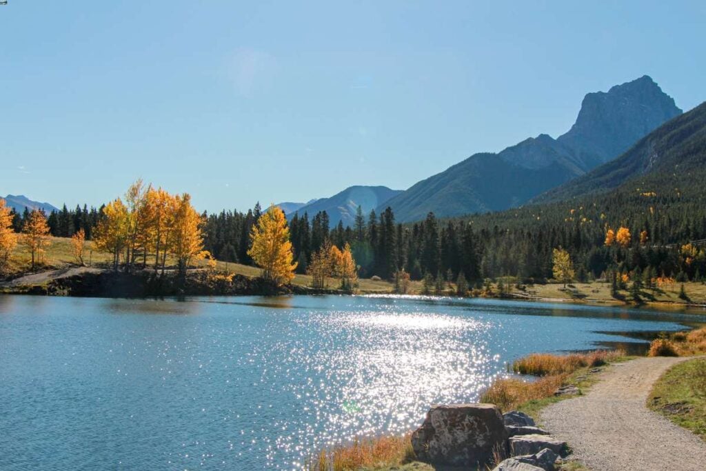
With picnic tables, a small beach, etc. there are so many things to do at Quarry Lake. When we visit Quarry Lake, we always love taking a stroll along the Quarry Lake Loop – a very easy, yet highly scenic walking trail around this beloved Canmore lake.

From the small beach area, you’ll enjoy incredible close-up views of Mount Rundle and Ha Ling Peak overhead. As you walk around the lake, the views of the Canadian Rockies change and you’ll see Grotto Mountain, Cougar Peak and Mount Lady Macdonald across the water.
The forest along the western side of Quarry Lake is the beginning of unimpeded mountain wilderness into Kananaskis Country. Keep a watchful eye as this is a great place to spot some Canadian wildlife, such as elk and deer.

A walk around Quarry Lake should be on everyone’s list of things to do in Canmore. We live here and the Rocky Mountain scenery along the Quarry Lake walking trail never fails to impress.

Quarry Lake Loop Quick Details
Distance: A full lap around the Quarry Lake Trail is 1.1 km (0.7 miles).
Elevation gain: There are a few minor hills on this easy walking trail, but they will not be of any consequence.
Parking for Quarry Lake: Being one of the most popular things to do in Canmore, Quarry Lake has a large paid parking lot.
3. Grassi Lakes Trail
Easily one of the most popular easy walking trails in Canmore is the Grassi Lakes Trail. Nestled in-between the base of Mount Rundle and Ha Ling Peak, the Grassi Lakes are a natural phenomenon which needs to be seen to be believed. When the sun is shining, the turquoise color of the lake water is stunning.

The walk to the Grassi Lakes Trail can be done via two different trails: one is an easy walking trail and the other is an easy hiking trail. This is why the Grassi Lakes Trail appears in both this list of easy Canmore walking trails and easy Kananaskis hikes.

This easy 2 km long (1.2 mile) Canmore walk is so popular, we’ve written an entire post on the Grassi Lakes Trail with all the details you need.
4. Canmore Reservoir Trail
The easy walking trail along the Canmore Reservoir (officially called the Rundle Forebay Reservoir) is easily one of the most scenic Canmore walking trails.
This perfectly flat trail follows the shoreline of the reservoir, while providing incredible 360-degree views of all of Canmore’s iconic mountain peaks. On a sunny day, the color of the water in the Rundle Forebay Reservoir is an incredible blue.

As you walk south to begin the trail, you’ll enjoy unimpeded views of Mount Rundle, Ha Ling Peak, Miners Peak, Mt. Lawrence Grassi, Ships Prow and the Three Sisters – you’ll even get an excellent view of the Grassi Lakes waterfall!
On the way back to the trailhead you’ll enjoy vistas of Grotto Mountain, Mount Lady Macdonald, Bald Eagle Peak and Pigeon Mountain.

One of the best things about this easy Canmore walk is that it is on a wide gravel trail. The extra-wide trail makes the Canmore reservoir trail perfect for families or a social walk with friends.
The Canmore reservoir is one of the best places to stand-up paddleboard near Banff. The small park near the parking lot is a popular spot for people to launch their SUPs and kayaks into the water. There’s a few benches to sit and soak in the Bow Valley mountain views.

Canmore Reservoir Trail Quick Details
Distance: You can turn around at any point, but if you walk the full length of the Rundle Forebay Reservoir, it’s 2.1 km (1.3 miles)one-way.
Elevation gain: This is one of the most perfectly flat walking trails around Canmore. You will not notice any elevation gain at all.
Parking: The free parking lot for this easy Canmore walking trail is on Spray Lakes Road, just opposite from the entrance to the Canmore Nordic Centre.
To get to the Canmore reservoir trailhead, simply walk from the parking lot along the north side of the reservoir, across the little dam, to get to the eastern shore. The trail is just beyond the vehicle barricade.
5. Powerline Connector Trail
At the far end of the Canmore Reservoir Trail is a spillway. If you are enjoying your leisurely Canmore walk along the reservoir and are not ready to turn around, simply turn east and follow the berm along the spillway. This short Canmore walking trail is called the Powerline Connector Trail.

What we like most about the Powerline Connector Trail is that it is surrounded on both sides by a beautiful forest, yet the walking trail is wide enough to allow you to continue enjoying Rocky Mountain views. The towering mountain wall looming overhead on your right belongs to Ha Ling Peak, while Grotto Mountain is visible straight ahead.

To enjoy the Powerline Connector Trail walk, simply follow along the top of the northern spillway berm. Don’t follow the trail down into the forest as that is Mosquito Bite – a very popular, easy Canmore mountain biking trail.
Powerline Connector Trail Quick Details
Distance: As you might guess by the name, this easy Canmore walk ends after 0.8 km (0.5 mi) when it meets up with the Powerline Trail.
Elevation gain: Aside from the small dip at the beginning of this walking trail, there is no noticeable elevation gain or loss at all.
6. TransCanada Trail – Three Sisters Mountain Village to Downtown Canmore
Did you know the TransCanada Trail runs straight through the heart of Canmore? The TransCanada Trail is not only the longest trail network in the world, but it is also one of our favorite Canmore walking trails. For most of this enjoyable walking trail, you’ll be surrounded by nature and you’d never know you are in the middle of a mountain resort town!

Our favorite section of the TransCanada Trail in Canmore is between Riverside Park (near downtown) and the Three Sisters Mountain Village.
The one-way walking distance of this beautiful Canmore walk is approximately 7 km (4.3 miles), so if you are in downtown Canmore, we recommend you take the free Roam 5T bus to the Stewart Creek bus stop in the Three Sisters Mountain Village and enjoy a pleasant downhill walk back to downtown Canmore.
The TransCanada Trail is well marked and easy to follow, but you can download a trail map on AllTrails if you’d like. The AllTrails version is slightly different than our walking path, but it is the same in all the important areas.
A recent App of the Year winner, AllTrails is also one of the best apps for visiting Banff! Enjoy map downloads and many more premium features with a 7-day free trial of AllTrails+!

Leg 1: Three Sisters Pathway to Cairns on the Bow
Our enjoyable Canmore walk along the TransCanada Trail begins on a paved pathway at the Stewart Creek bus stop. This leg of the trail is known locally as the Three Sisters Pathway. Highlights of this leg of the Three Sisters Pathway include:
- Incredible mountain vistas from the Our Lady of the Snows school field. From here, you’ll love the views of the surrounding mountains including Hope (the little sister), Ships Prow, Mount Lawrence Grassi, Ha Ling Peak, Rundle Mountain, Grotto Mountain and Mount Lady Macdonald.
- The Market Bistro – one of the best lunch restaurants in Canmore, the Market Bistro is an excellent french-inspired bistro tucked away in a quiet residential neighborhood of Canmore.
- The Three Sisters Creek Bridge: This beautiful bridge is a nice place to stop and soak in views of Bald Eagle Peak across the Bow Valley. It’s also a popular spot for kids to stop and throw rocks into the creek.

Recommended Detour: We hate to disagree with the good folks at the TransCanada Trail, but we have a slight detour to recommend. When you are in the Our Lady of the Snows school field, the paved walking trail forks – the TransCanada Trail goes to the right, but we recommend you take the left trail. (You can follow along on Google Maps if you’d like)
This paved walking trail is much more open and provides ongoing vistas of the surrounding Canadian Rockies. Along the way, you’ll pass the Canmore Train Playground (popular with little kids), the Three Sisters Disc Golf Course and a fenced-in off leash dog park.
When you reach the end of the paved walking trail, take a left down the gravel path which follows Three Sisters Creek until it reaches the TransCanada Trail, just steps away from the Three Sisters Creek bridge.

Leg 2: Three Sisters Pathway to the Prospect Heights Meadow
The next leg of the TransCanada Trail continues as you cross the Three Sisters Parkway.
Recommended Detour: We have one more recommended detour off the Three Sisters Pathway. Bear with us – this is our last detour, but trust us – it’s worth it – this leg is one of the nicest walking trails in Canmore.

As soon as you cross the Three Sisters Parkway, the paved trail forks. The TransCanada Trail continues to the left. If you stay on this trail, all you will see are glimpses of the multi-million dollar mansions in the Cairns on the Bow development and vehicle traffic on the adjacent Three Sisters Parkway.
Our highly recommended detour goes straight instead of left. The paved path soon turns gravel and goes down a hill via a few switchbacks until you reach the shores of the beautiful Bow River.
From here the walking trail meanders through a beautiful forest along a tranquil tributary of the Bow River. The mountain reflections on the glasslike water are too beautiful to describe.

Our detour is only 400 m (1,300 ft) longer than the official TransCanada Trail route long. You can follow along on this Google Map.
Once you rejoin the main TransCanada Trail you’ll walk through a beautiful forest next to the Bow River. You’ll climb a short hill, where you’ll see an old coal mining cart on your way to an amazing viewpoint of Ha Ling Peak and Mount Rundle.

As you descend the hill, the Prospect Heights meadow is spread out in front of you, with impressive views of the Bow Valley mountains which lead the way to Banff National Park.

Leg 3: Prospect Heights to Downtown Canmore
The final leg of our walk along the TransCanada Trail to downtown Canmore is very scenic. It begins with a walk along the Bow River through the Prospect Heights Meadow, then transitions to West Canmore Park, before crossing the Bow River to Riverside Park.
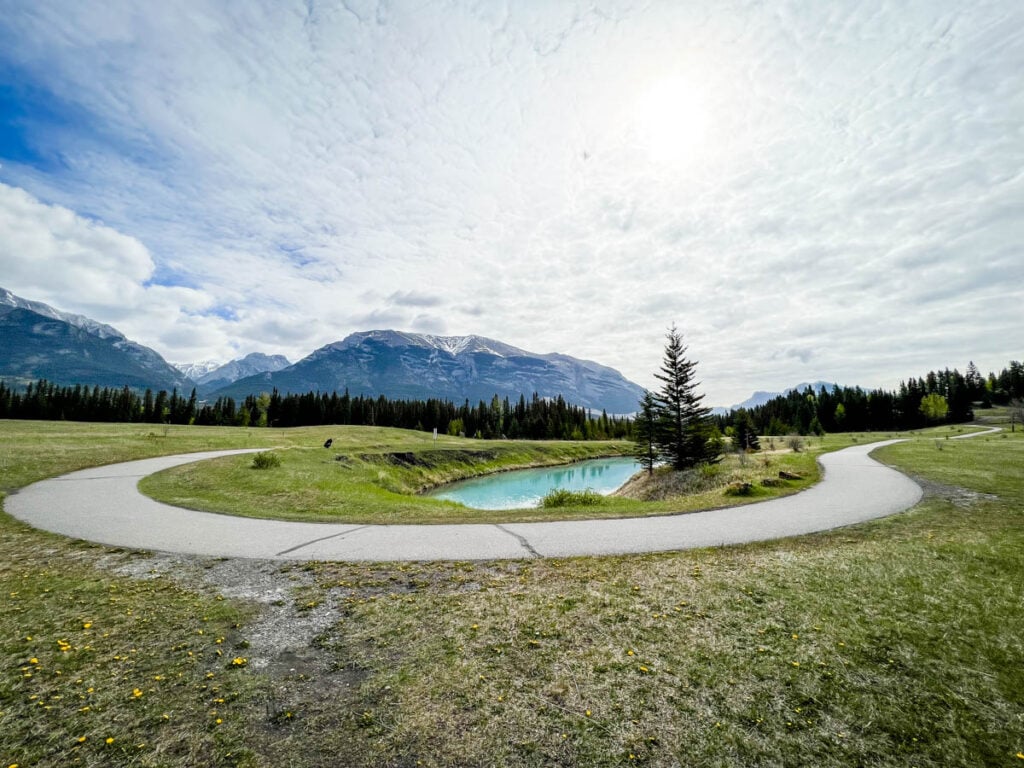
Highlights of this leg of the TransCanada Trail include:
- The Stinky River: There’s a natural spring in the Prospect Heights meadow that has an incredible blue color, but it also smells strongly of sulphur. Our kids call this beautiful natural spring the stinky river.
- The coal mining history: Historically Canmore was a coal mining town. You can see pieces of this history in the meadow where you’ll find an old mine entrance and an old coal mining cart. To find them, walk away from the Bow River at the Stinky River – they are approximately here.
- Canmore Creek: As the trail nears West Canmore Park, you’ll walk perpendicular to Canmore Creek. The meadow beyond Canmore Creek is a wonderful spot to look for wildlife. In addition to the plentiful waterfowl, we’ve seen bears, deer and elk in this spot.

Continue along the trail, passing the excellent Canmore playground in West Canmore Park. The trail eventually reaches a pedestrian bridge over the Bow River. Cross the bridge and then take the underpass to reach Riverside Park, the ending point of this highly enjoyable Canmore walking trail.
7. Bow River Loop
In addition to the Policeman’s Creek Boardwalk, the Bow River Loop is one of the nicest Canmore walking trails within easy reach of downtown. An enjoyable short walking path, the Bow River Loop packs in a lot of scenery and a little Canmore history as well.

As you can see from the Bow River Loop trail map, there are several access points to this easy Canmore walking trail. Our our purposes, we’ll begin the description of this easy walk from Riverside Park.
Riverside Park is a popular Canmore picnic spot sandwiched in-between downtown Canmore and the Bow River. From here, the Bow River Loop follows the river on the Higashikawa Trail (named after Canmore’s sister city in Japan). Watch for little spur trails which lead to scenic benches along the Bow River.

Before long the Bow River Loop reaches the iconic and highly photogenic Engine Bridge. Built by the Canadian Pacific Railway (CPR) in 1891 to support a coal mine, this solid industrial bridge is now a popular spot to stroll and enjoy views of the surrounding mountains as you cross the Bow River.
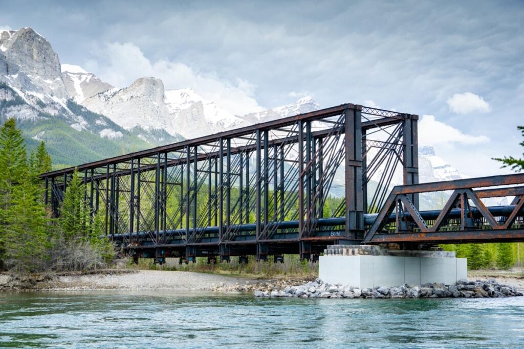
Beyond the Canmore Engine Bridge, the walking trail continues through a pleasant forest before passing a small hydroelectric power plant. The water released from this plant flows very gently towards the Bow River. This is a very popular spot for kids to stop and throw rocks in the water.
This Canmore walking trail is also one of the best things to do in Canmore in winter!

The Bow River Loop ends by crossing the Bow River Pedestrian Bridge, leading back to Riverside Park.
Bow River Loop Trail Quick Details
Distance: This scenic walking path is just over 2 km (1.2 miles) long.
Parking for the Bow River Loop: There are two parking lots near the Bow River Loop walking trail:
- Riverside Park parking lot along River Road
- Bow River Boat Launch parking lot
Elevation gain: There are no noticeable hills on the Bow River Loop trail. Walkers enjoying this easy trail will not notice any elevation gain.
8. Larch Island Interpretive Trail
The Larch Island Interpretive Trail is a beautiful forest and river walk near Canmore. I use the phrase near Canmore as this easy walking trail crosses from the Town of Canmore into the Canmore Nordic Centre Provincial Park, which is part of Kananaskis Country.
To get to the Larch Islands trail, we recommend you start in Riverside Park near downtown Canmore. This initial stretch of walking path is the along Higashikawa Trail, which is the same as the start of the Bow River Loop. Once you reach the old railway bridge, continue straight to get to the Larch Island Interpretive Trail.

Beyond the old railway bridge, the 4-person wide crushed gravel trail follows the shores of the Bow River for a while. Take a moment to look behind you to see a postcard worthy view of Ha Ling Peak looming over the Bow River and the engine bridge.

The walking trail continues straight as the Bow River suddenly takes a sharp left, leaving you to follow a sleepy tributary of the river as you enter the forest. From the old railway bridge it’s only 700 m (0.4 mi) to the Larch Island trailhead.
The Larch Island trail starts on the other side of a cute little wooden bridge. Upon crossing, you’ll now be in Kananaskis Country. Larch Island has been protected due to the sensitive and uncommon plants which grow here due to the high groundwater table.
Please help protect this special area by staying on the walking trail.

Larch Island is home to a beautiful, dense forest near the Bow River, which is prime wildlife habitat. Keep your eyes and ears open for wildlife, while making lots of noise to alert any bears of your presence.
As the Larch island interpretive trail nears the Bow River, the trees become less dense, opening up views of the Canadian Rockies – from Mount Rundle all the way to the Three Sisters. There are a few short spur trails to scenic spots along the shores of the Bow River, some of which have benches to sit and soak in the views.

Along the Larch Island trail you will see signposts with a number on them. These numbered posts were tied to an interpretive guide called Larch Island: A Story Walk, originally published in 1923! This interpretive guide has recently been digitized and can now be downloaded onto your phone as a Larch Island audioguide.
The walking trail through Larch Island is a dirt trail, with some protruding tree roots, but walkers of most ability levels should manage without issue.

When you reach the end of the trail, you can simply turn right and head back towards the railway bridge and Riverside Park, but if you have the time and energy, a nice way to extend this easy Canmore walk is to turn left and enjoy a beautiful nature walk all the way to Policeman’s Creek.
Larch Island Trail Quick Details
Distance: The one-way distance of this enjoyable Canmore / Kananaskis walk is 2.5 km (1.6 miles) from Riverside Park to the end of the Larch Island Trail
Elevation gain: There is virtually no noticeable elevation gain or loss at all on this walk.
Parking for the Larch Island Trail: There are two parking lots near Riverside Park:
- Riverside Park parking lot along River Road
- Bow River Boat Launch parking lot
9. Larch Island to Policeman’s Creek
After leaving Larch Island, turn north on the paved Town of Canmore walking trail. The forest remains on the left, but on the right you’ll enjoy an eclectic group of houses.
Before long, you’ll reach a junction which shows a short walk to the shores of the Bow River. Ignore this trail (it’s usually just a dry riverbed) and take a sharp right instead to head towards Policeman’s Creek.

From the junction it’s about 2.7 km (1.7 miles) to reach the Big Head and the trailhead for the Policeman’s Creek boardwalk. Along the way, you’ll enjoy a beautiful walk through the forest, passing the Canmore Golf and Curling Club, and a nice long stroll along the northern section of Policeman’s Creek (upstream of the popular boardwalk trail).
The walking trail passes the Spur Line Trail along the way if you’d like to cut back to Riverside Park.

Larch Island to Policeman’s Creek Quick Details
Trail Map from Larch Island to Policeman’s Creek
Distance: All told, the walk from the Engine Bridge, through Larch Island, all the way around to the Policeman’s Creek trailhead is 4.9 km (3 miles).
Elevation gain: You’ll barely notice any change in elevation along this enjoyable nature walk near downtown Canmore.
10. Georgetown Interpretive Trail
The Georgetown Interpretive Trail is an easy walking trail in the Canmore Nordic Centre Provincial Park. The Georgetown Trail is nice and wide, reasonably flat, with few tree roots protruding. This combination makes this easy Canmore walking trail great for a family walk with kids or a social walk with friends.

The trailhead for the Georgetown Interpretive Trail is at the top of the staircase uphill of the small hydroelectric plant on the Bow River Loop. This easy Canmore hike is mostly through a lush mixed forest with a marshmallowy carpet of moss, but there are occasional clearings which allow for nice views of the eastern mountains of the Bow Valley (such as Grotto Mountain, Mount Lady Macdonald, Bald Eagle Peak, etc.) and the Bow River.
The Georgetown Trail ends at a clearing with a picnic table and a few interpretive signs about the abandoned Georgetown coal mining town. A few foundations, etc. of the Georgetown ghost town can be seen through the trees on the informal trail which continues on past the picnic table. (If you like ghost towns, don’t miss the Bankhead ghost town in Banff.)

Of all the Canmore walking trails listed here, the Georgetown trail is the closest to a real hiking trail, so be sure to walk with bear spray. On our most recent walk along the Georgetown Trail, there were ample signs of bear activity including large scat piles and many diggings.
Georgetown Trail Quick Details
Distance: The full distance of this easy Canmore walking trail from Riverside Park to the picnic table and back is 7.2 km (4.5 miles)
Elevation Gain: The biggest challenge for most on the Georgetown Trail will be the stairs by the hydro plant, but they should be easily doable for most walkers. The walking trail has a slight uphill, followed by a slight downhill.
Given the trail is rarely flat, the total elevation gain on this walking trail is approximately 300 m (980 feet), which sounds like a lot, but in reality, the hills are quite gentle.
Parking: You have two parking options for the Georgetown Trail:
- The more scenic route would be to park at Riverside Park in downtown Canmore and then walk along the Bow River Loop to the power plant. The Georgetown Trail starts at the top of these stairs.
- You could also park at the Canmore Nordic Centre and walk down the Canmore Trail to the Georgetown trailhead. (Do not walk down the Soft Yoghurt trail). Be aware that if you park at the Nordic Centre, your vehicle will need a Kananaskis Conservation Pass.
11. Benchlands Ridge Trail
Another of our favorite easy Canmore walks is the Benchlands Ridge Trail. The trailhead for this Canmore walking trail begins along Benchlands Trail, halfway between the Iron Goat and the TransCanada Highway. You’ll easily identify the trailhead as there is a posted trail map below a long set of stairs.

The stairs are pretty easy, and before long you are walking along Benchlands Ridge, overlooking the Town of Canmore and the beautiful Bow Valley.
It’s quite amazing how such little physical effort can provide such amazing views of the Canadian rocky mountains – you can see as far south as Mount Allan (where the Nakiska Ski Hill is), to the very far end of Mount Rundle to the north. The views of Canmore’s Three Sisters mountain are especially nice from up here.
It’s not just mountain views along the Benchlands Ridge Trail, there are great views of the Town of Canmore as well.
From this vantage point, you can see the Canmore cemetery and Benchlands bike skills park right below the trail, while you can see fun Canmore landmarks such as Elevation Place. At the far end of town, you can see the large waterfall which runs next to the Grassi Lakes Trail.
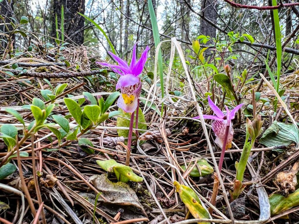
You’ll be walking along a gravel path with a gentle uphill incline. Due to the southern exposure, it’s a great place to find crocus flowers and delicate calypso orchids growing in early spring. If architecture is your thing, there are many beautiful and interesting houses along Benchlands Ridge to admire.
After 800 m (0.5 miles) of walking, you’ll arrive at a series of three park benches. You probably don’t need a rest at this stage, but feel free to stop and soak in the million dollar views. When you are ready to go, take one of the spur trails down the hill for a close-up look at the Canmore hoodoos.

This post is limited to Canmore walking trails only, but if you’d like to enjoy one of Canmore’s easy hiking trails, you can continue past the benches and enjoy a walk through the Eagle Terrace Conservation Area.
Benchlands Ridge Trail Quick Details
Benchlands Ridge Trail Map: You can use this trail map only for the walk to the benches overlooking the Canmore hoodoos. Beyond that, the hiking trail map is outdated and not useful.
Distance: From the Iron Goat, the distance to the benches over the Canmore hoodoos is 1.3 km (0.8 miles)
Elevation Gain: The walk from the Iron Goat to the trailhead is a gentle downhill where you will lose about 30 m (100 feet) in elevation. The Benchlands Ridge Trail itself is a gentle uphill where you will gain approximately 20 m (66 feet) in elevation.
Parking for the Benchlands Ridge Trail: The best place to park for the Benchlands Ridge Loop is the Cougar Creek parking lot.
12. Spur Line Trail
Just 0.7 km long, the Spur Line trail is one of the shortest Canmore walking trails on our list. Officially part of the TransCanada Trail, the Spur Line trail is an important connector trail which runs from the Engine Bridge to Policeman’s Creek.
Starting at the Canmore Engine Bridge (which connects to the Bow River Loop), the Spur Line runs eastward through a nice forest. After 200 m (650 feet), the Spur Line transitions to a path through a residential back alley.
The Spur Line then reenters the forest and runs in-between several Canmore ponds. These ponds are where we come with our kids each spring to look for baby ducks.

The Spur Line ends when it reaches Policeman’s Creek. You can turn right here and follow the trail to reach the Policeman’s Creek boardwalk trail, or you can continue straight to reach one of Canmore’s largest shopping areas.
13. Benchlands Trail
A popular walking and cycling trail for locals, the Benchlands Trail is an enjoyable walk into a residential area of Canmore, away from all the touristy stuff.
The Benchlands trailhead is found just across the TransCanada Highway from the Shops of Canmore. From here, the paved walking trail weaves in and out of trees, following the vehicle road of the same name (Benchlands Trail) to the Cougar Creek parking lot.

Along the way, you’ll have fun watching kids do awesome tricks on their mountain bikes at the Benchlands Trail Bike Skills Park. You’ll also pass the trailhead for the Canmore hoodoos trail and the Benchlands Ridge Trail, one of our favorite easy Canmore hikes.
Why take the time to walk the Benchlands Trail? At the end, you’ll pass the Summit Cafe (one of our favorite Canmore breakfast restaurants) and a shopping area with the Iron Goat (an excellent restaurant with even better views).
For a special treat, pop into Le Chocolatier for handmade Belgian chocolate creations. And, if you are visiting Canmore with kids, one of the best playgrounds in Canmore is just minutes away in Eagle Terrace.
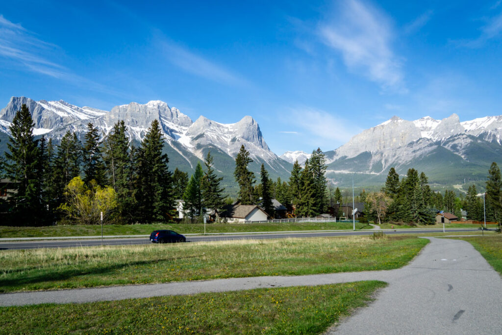
You can also continue on to the Cougar Creek parking lot, where you’ll find another of our favorite Canmore walks, as well as the trailhead for some of Canmore’s best hikes, such as the Mount Lady Macdonald trail and the Montane Traverse Trail.
If you’d like to turn this Canmore walking trail into a loop, simply proceed to the Cougar Creek parking lot and start walking downhill. When you reach the bridge at the bottom, take a right on the Palliser Trail, which will take you back to the start of the Benchlands trail.
Benchlands Trail Quick Details
Distance: It’s 1.1 km (0.7 miles) from the Cougar Creek parking lot to the TransCanada Highway
Elevation Gain: If you walk the Benchlands Trail from the bottom (near downtown Canmore) to the top, it’s an uphill walk the entire way with approximately 65 m (215 ft) of elevation gain.
Parking lot: There is a small parking lot near the Benchlands bike skills park. Alternately, you could park at the Cougar Creek trailhead.
14. Palliser Trail
The Palliser Trail is a paved walking path which runs parallel to the TransCanada highway. There are several access points to the Palliser Trail which runs from the bottom of Cougar Creek all the way to the hamlet of Harvey Heights, at the doorstep to Banff National Park.
Although the traffic noise from the nearby TransCanada Highway can impact the ambiance of this Canmore walk, you’ll quickly forgive the noise as the wide open spaces provide virtually unimpeded views of all the Bow Valley mountains, stretching as far as Mount Allen (home of the Nakiska ski hill in Kananaskis Country) to Cascade Mountain (which overlooks the Town of Banff).

Palliser Trail Quick Details
Distance: Walk as much, or as little as you’d like along this 6.4 km (4 mi) walking trail
Parking: Two popular access points for the Palliser Trail are:
- the same spot where the Benchlands Trailhead
- The pedestrian underpass under the TransCanada Highway near the Shops of Canmore
Elevation Gain: There are a few small hills along the Palliser Trail, but this Canmore walking trail is otherwise flat.
15. Cougar Creek Walking Trail
Cougar Creek gained notoriety during the devastating Alberta floods of July 2013. The extraordinary amount of rainfall, coupled with an unusually high snowpack, turned the usually sleepy Cougar Creek into a raging, destructive monster.
Today, Cougar Creek has been transformed. It is no longer a natural mountain creek, but a concrete waterway, specially designed to help handle the next flood event. Although the creek bed is no longer natural, the walking paths along both shores of Cougar Creek provide a fascinating opportunity to see how a mountain resort town attempts to mitigate future flood risk.
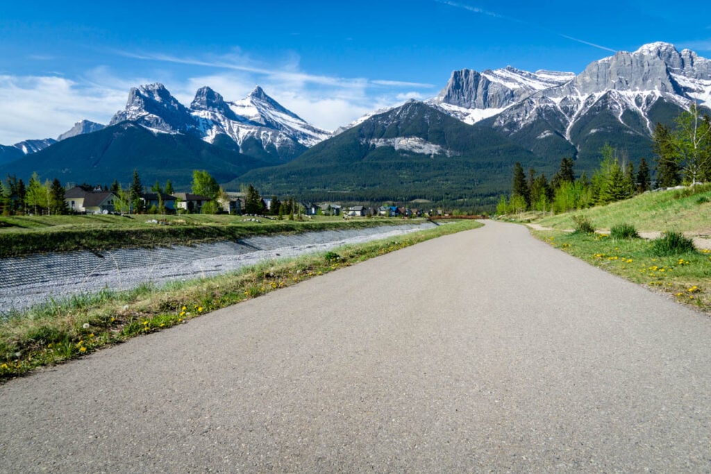
As you walk upstream along Cougar Creek, you’ll enjoy up-close views of Mount Lady Macdonald, Grotto Mountain, with Cougar Peak in the middle. On the way back down, the views of the south side of the Bow Valley are breathtaking, with the Three Sisters mountains looking especially majestic.

Cougar Creek Trail Quick Details
Distance: Depending on how far you go up and down the Cougar Creek walking paths, you can go as far as 1.5 km (0.9 miles) each way. Flood mitigation works continues upstream and sometimes impacts how far you can walk.
Elevation gain: From the bottom of Cougar Creek (at the Palliser trailhead) to the Cougar Creek parking lot, you’ll have about 80 m (260 feet) in elevation gain.
Parking: The most convenient parking spot to access the Cougar Creek trails is near the Benchlands traffic circle.
That’s it! We hope you found some enjoyable outings in our list of our favorite easy Canmore walking trails.
Please Support Human Created Content
This post was written by a local who lives just minutes outside Banff National Park. If this post was helpful, and you value getting accurate Banff advice from a real human (not AI), please click here to make a small donation or explore other easy ways support our small business. Every bit makes a difference.
More About Canmore, Alberta
Additional Easy Hikes Near Canmore
Found this post useful? Save it or share it with your friends!

Dan Brewer, a life-long Alberta resident, calls Canmore home along with his wife and two kids. He is the co-owner of Travel Banff Canada, where he gets to share his passion for the Canadian Rocky Mountains. Dan, along with his family, love being outdoors doing one of the many activities they enjoy in the mountains: hiking, mountain biking, paddleboarding, skiing, snowshoeing and cross-country skiing.
When he's not in Canmore enjoying one of his favourite local hikes, you can find him hoping on a plane to explore a new country with his family or working on one of their other two travel sites: Family Can Travel and Baby Can Travel.


