Lake O’Hara isn’t just one of the most beautiful places in the Canadian Rockies, it’s also home to some of the most spectacular hiking trails in all of Canada. Surrounded by towering mountains, tranquil alpine meadows, and emerald lakes, Lake O’Hara hiking trails never disappoint.
Located in Yoho National Park, just minutes from Lake Louise & Banff National Park, Lake O’Hara is also one of the most exclusive places to hike in the Canadian Rockies. The number of daily visitors to Lake O’Hara is limited by Parks Canada to protect the fragile alpine environment. This means you’ll need to learn how to get to Lake O’Hara, which is usually with a coveted shuttle reservation, or the determination to hike the boring old 11 km access road.
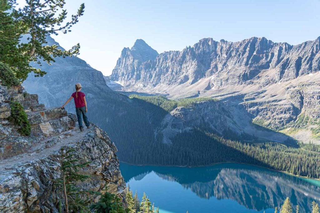
For the lucky few who make it to Lake O’Hara, the reward is immense. The trail network at Lake O’Hara is world-class, offering everything from easy lakeside strolls to dramatic high alpine routes. In larch season, this area becomes a golden wonderland, home to some of the best larch hikes in the Rockies.
In this post, you’ll find an overview of the best hikes at Lake O’Hara, what to expect and how to access them, and why they’re worth the effort to get here.
This post contains compensated links.
Lake O’Hara Hiking Season
Each year is different, but the typical hiking season in Lake O’Hara runs from July until late-September. Any time before July, you may discover the higher altitude routes are unsafe due to snowpack and avalanche hazards.

Preparing to Hike at Lake O’Hara
Before you do any hiking at Lake O’Hara, we recommend you do three things:
1. Get AllTrails+
The trail network at Lake O’Hara is extensive and can get confusing at times. If you don’t already have it, I recommend getting an AllTrails+ subscription, so you can download your trail maps onto your phone. You can then track your actual location to your intended trail, and can help you get back on track if you take a wrong turn. I will provide AllTrails links to the most popular Lake O’Hara hiking trails below.

Banff App Pick
AllTrails is one of our most recommended apps for visiting Banff, and your trip is the perfect time to try AllTrails Plus. Start with the 7-day free trial to download maps, save hikes, and use premium features before heading into the mountains.
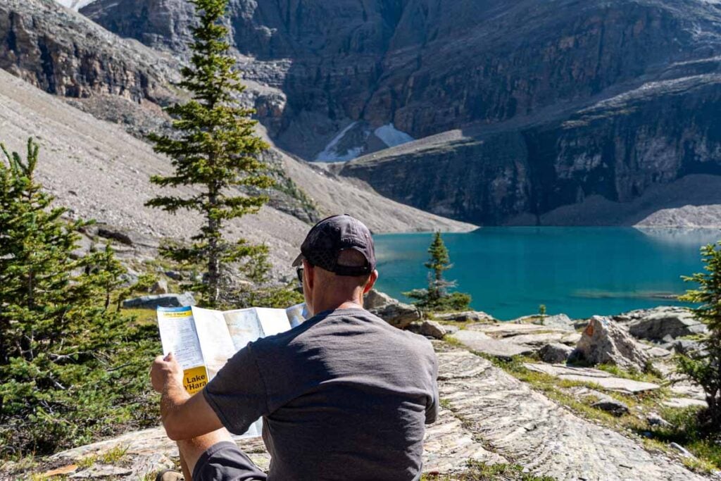
2. Buy the Lake O’Hara Gem Trek Map
Pick up the Lake O’Hara hiking map by Gem Trek. This excellent topographical hiking map is a great companion to having AllTrails on your phone. The downside with AllTrails is that you can only track one hiking trail at a time, but there are so many trails in Lake O’Hara, you may want to modify your route or try something new. I pull out my Lake O’Hara Gem Trek map all the time while hiking this area – it really helps!
3. Check Trail Conditions and Closures
Finally, before you go hiking in this special area of Yoho National Park, it is imperative that you check the current Lake O’Hara trail conditions and for any trail closures which may impact your route.

Lake O’Hara Hiking Trails
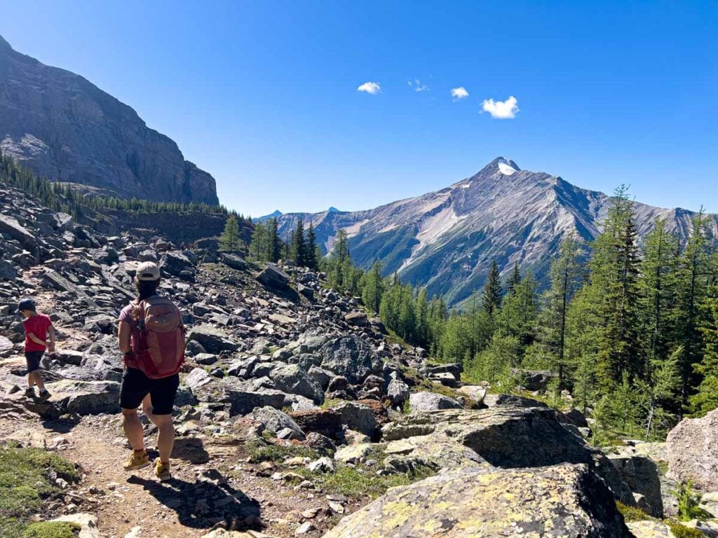
There are a wide variety of inter-connected hiking trails around the Lake O’Hara area. The good news is that hikers can string together a collection of these hiking trails to create a longer trail perfect for their skill level.
As a result, there’s a near infinite number of hiking trail combinations at Lake O’Hara. You can enjoy anything from leisurely strolls around the lakeshore, to challenging alpine circuits, and everything in-between.
To help you plan your day of hiking at Lake O’Hara, I will discuss your options in two main sections:
- I will list the five most popular non-Alpine Circuit trails at Lake O’Hara.
- The four main sections of the famous Lake O’Hara Alpine Circuit (a difficult hiking trail – not for everyone!)
5 Excellent Lake O’Hara Hiking Trails (non-Alpine Circuit)
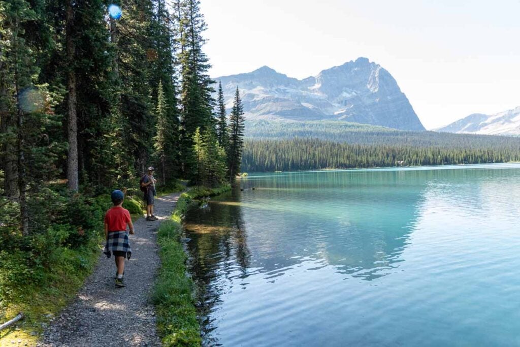
1. Lakeshore Trail
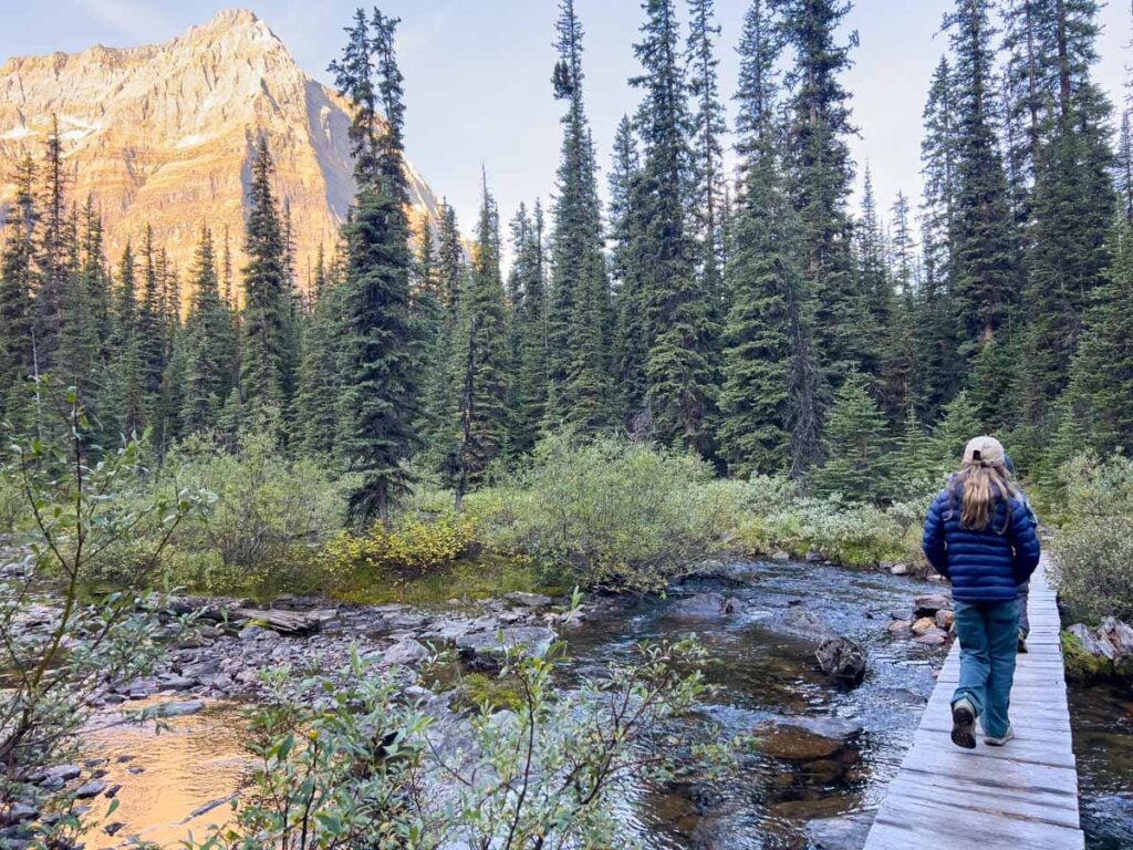
The Lakeshore trail is the easiest hike in the Lake O’Hara area. This 2.9 km loop around Lake O’Hara is a perfect hike for those who are not interested in some of the more challenging alpine hikes. At the far end of the lake, there’s an option for a short spur trail to see the Seven Veils Falls.

Given it only takes about 45 minutes to complete the loop around the lake, it’s also a great hike for anyone with some time to kill before catching their shuttle bus back to the parking lot.
Download the Lake O’Hara Shoreline Trail Map
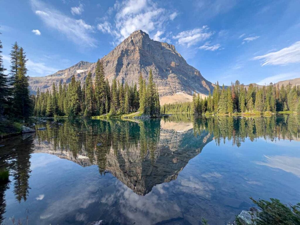
2. Lake Oesa Trail
The Lake Oesa trail is considered by many to be the best easy hiking trail at Lake O’Hara. The 3.2 km (one-way) trail runs along the Lakeshore Trail for about a kilometer, before ascending a short stretch of switchbacks.
Once at the top of the switchbacks, it’s a slow and steady incline to Lake Oesa. Along the way you’ll pass Victoria Falls over stone steps made by Banff legend, Lawrence Grassi.

The upper part of the Lake Oesa trail is especially beautiful. The hiking trail is along rock steps, through a forest of larch trees with streams and lakes.
We saw a noble marmot sunning on a rock overlooking Victoria Lake and could hear pikas in the surrounding rocks. In fall, the sight of golden larch trees reflecting on the glasslike, turquoise water of Victoria Lake is breathtaking.

Download the Lake Oesa Trail Map
3. Lake McArthur Trail
This outstanding Lake O’Hara hiking trail is quite possibly the only triple figure-8 hiking trail I’ve seen anywhere in the world! (I told you the trail network at Lake O’Hara can be confusing at times – make sure you have your digital and paper maps with you!).
The 7.2 km hike to Lake McArthur and back is via a series of interconnected hiking trails. Here’s a look at what you’ll experience hiking to Lake McArthur:
3A: Alpine Meadow Trail
The hike to Lake McArthur begins at the Le Relais Day Shelter (bring cash for carrot cake!). Before long you’ll be on the Alpine Meadow trail, which (surprise!) is through a beautiful alpine meadow.
The Alpine Meadows trail runs from the Elizabeth Parker Hut to Schaffer Lake. This trail can be steep at times and runs through a mixed forest of evergreens and larch trees, often with a stream running alongside. Due to less tree cover, you’ll enjoy excellent views of the surrounding mountains from the meadow.

3B: McArthur Pass Loop
The middle loop of the triple figure-8 begins once you reach the shores of Schaffer Lake. Going clockwise through the loop, this short section of trail is a gradual ascent through forest and meadow to the beginning of the Lake McArthur Loop Trail.
(You’ll take the other side of this loop trail on the way back to Lake O’Hara).
3C: Lake McArthur High Level Trail
AllTrails suggests taking the Low Level Trail first, but I find it more enjoyable to do it counter-clockwise. Either way is amazing! (Are you starting to see why you need AllTrails+ and a paper map for hiking Lake O’Hara?? This is confusing!)
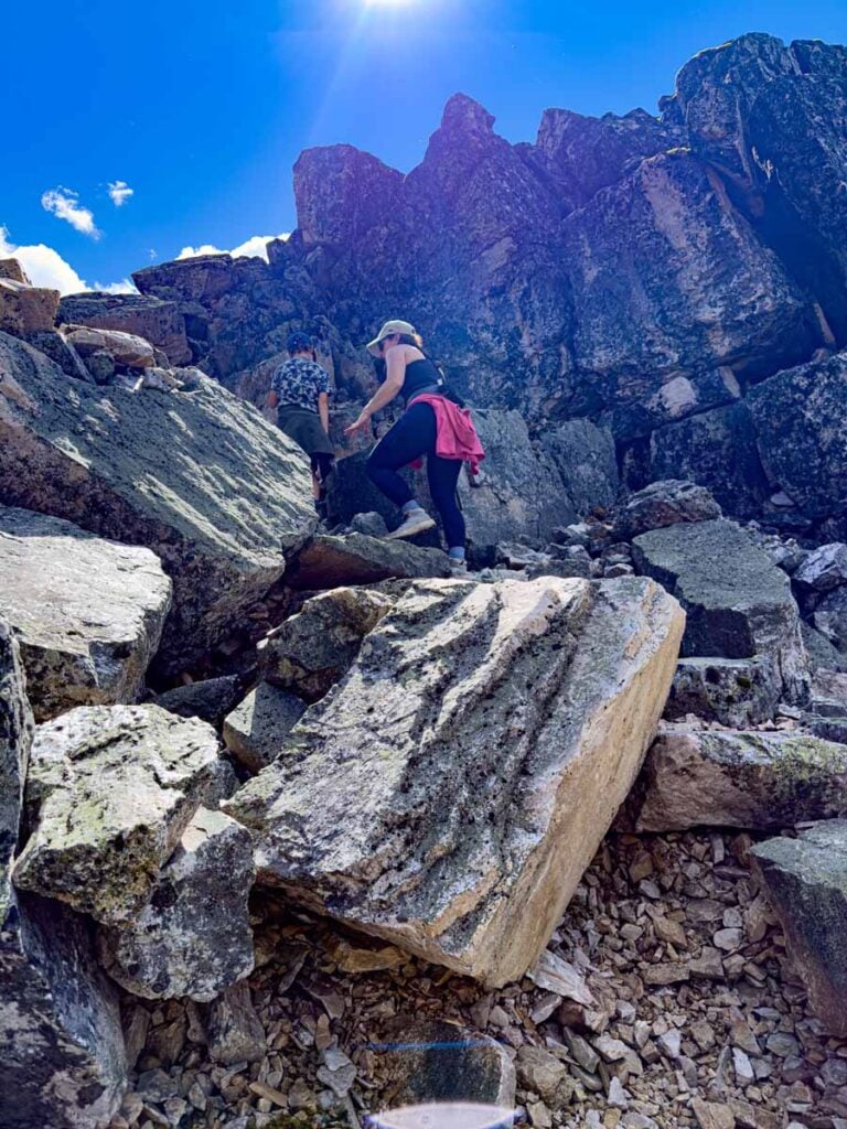
I love hiking the High Level Trail to Lake McArthur. As you gain altitude, you emerge from the trees, allowing amazing 360° views of the surrounding Rocky Mountains. There’s a section which involves a small scramble where you need to climb up and over a tall rock face. It’s a little challenging, but if you are capable of hiking this far, you should be able to do it.
3D: Lake McArthur
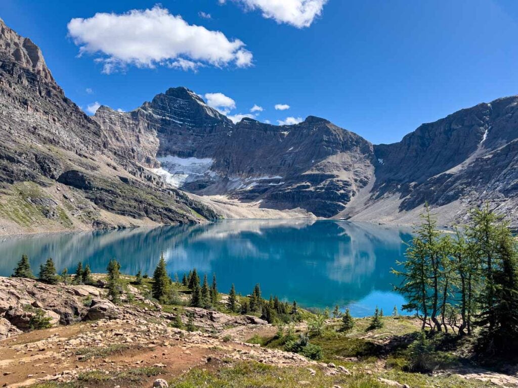
There are few lakes in the world with a more stunning location than Lake McArthur. From the moment you see the peacock-blue waters of Lake McArthur, your breath will be taken away.
Lake McArthur rests at the foot of the majestic Mt. Biddle (3,319 m), with Park Mountain (2,941 m) and Mount Schaffer along the sides. With stunning mountains towering overhead on three sides, this is an incredible spot to stop and soak in the majesty of the Lake O’Hara area. Take a moment to stop and reflect on how lucky you are to even be there and appreciate the moment.
3E: Lake McArthur Low Level Trail
As opposed to the High Level Trail, the Lake McArthur Low Level Trail is more gradual and has more trees (i.e.: less scenic and less fun). It’s still worth taking it back to McArthur Pass for a variety of scenery, but if you are able, take the High Level Trail to the lake and the Low Level trail back.
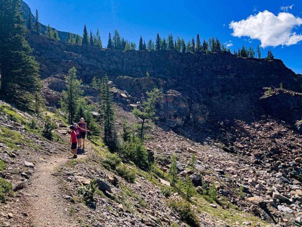
3F. Big Larches Trail
After taking the other side of the McArthur Pass loop, you’ll reach the final leg of Lake McArthur hike. The aptly named Big Larches trail is a beautiful hiking trail connects Schaffer Lake to Le Relais Day Shelter (via the end of the West Opabin trail – near Mary Lake).
The Big Larches hiking trail runs through the remnants of a rockslide from Mount Schaffer (2,692 m).

It seems at one time, this would have been a large forest of larch trees, but the rockslide engulfed many of these iconic fall trees. There are still plenty of large larch trees remaining along the outskirts of the rockslide, and the Big Larches trail leads you right through them.

In addition to the impressive rockslide and the larch trees, there are many wonderful views from the Big Larches trail. You’ll enjoy aerial views of Mary Lake and Lake O’Hara. There are also great views of the Wiwaxy Peaks (2,703 m) and Mount Huber (3,368 m), providing a fun glimpse at the alpine circuit hiking trails on those mountains.
I don’t blame you for being confused. Do yourself a big favor and download the Lake McArthur Trail Map. It’s really not as confusing as it seems, and the views are outstanding!!
4. Opabin Plateau Circuit
Similar to the Lake Oesa Trail, the 7.6 km Opabin Plateau Circuit connects a series of trails together to visit a series of lakes and an incredible viewpoint of Lake O’Hara.
4A. Lakeshore Trail
As opposed to the Lake Oesa Trail, the Opabin Plateau trail follows the Lakeshore Trail along the south shore of Lake O’Hara. It’s a fun opportunity to see the Lake O’Hara Lodge up close as you make your way to the first Opabin Trail.
4B. East Opabin Trail
The East Opabin trail connects Lake O’Hara to Opabin Lake. From the lakeshore, you’ll hike up a series of switchbacks until you reach the meadow with the lakes. This route is the preferred route to Opabin Lake as the uphill section is not as steep as on the West Opabin route.
As the trail gains elevation, it opens up to reveal expansive views of the surrounding peaks and valleys. You’ll pass by the Moore Lakes, and Hungabee Lake before arriving at the stunning Opabin Lake. As with all the lakes in the region, it’s a stunning setting beneath towering peaks, which are often reflected in its calm waters.

4C. Opabin Plateau Trail
If you can pull yourself away from the scenery at Opabin Lake, follow the Opabin Plateau Trail along the far side of Hungabee Lake and the Moore Lakes to get the to the Opabin Plateau.
4D. Opabin Prospect Trail
On our first-ever visit to Lake O’Hara, we kept eyeing a plateau covered with golden larch trees. We figured we’d hike through it as we completed our hiking circuit of the area, but we were disappointed to find out we missed it! We made sure to come back on a subsequent visit, and the views were totally worth it!

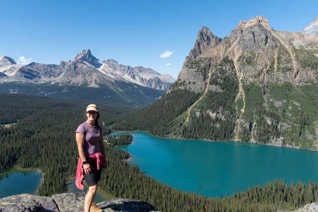
The Opabin Prospect trail takes you to the edge of the Opabin Plateau overlooking the Lake O’Hara valley. This is a great spot to stop for lunch, or at a minimum, a great picture. It’s one of the most iconic photos you can take of Lake O’Hara and is not to be missed!
4E. West Opabin Trail
You’ll get back to the start of your hike the West Opabin Trail. The final leg of the Opabin Plateau Circuit is very steep downhill, with excellent views of Mary Lake below. As you descend, the larch forest gives way to a traditional evergreen forest, often with a towering rock wall soaring overhead.

The AllTrails Map for the Opabin Plateau Circuit shows a clockwise direction. The route I describe above is counter-clockwise to take advantage of the less steep ascent on the East Opabin Trail.
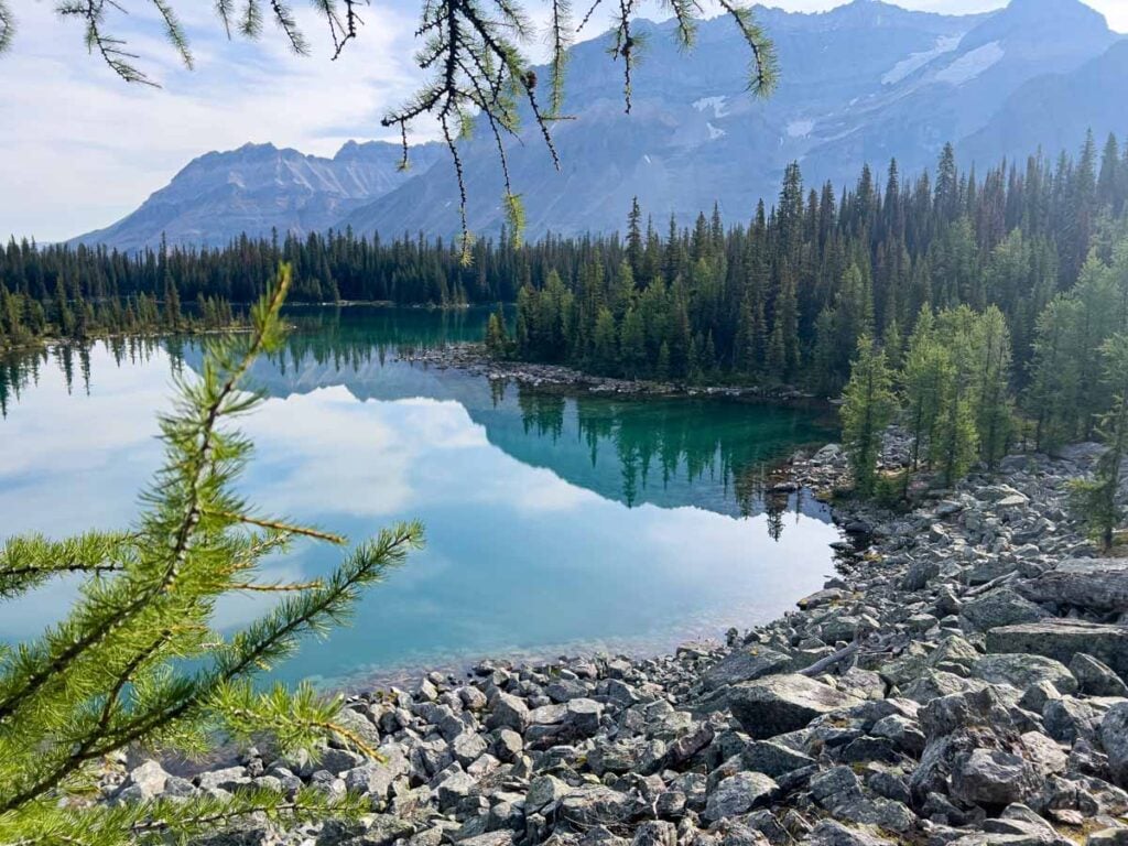
5. Linda Lake
Thanks to the daily visitor limitations for Lake O’Hara, it’s rare to see another hiker on the trails. If you really want to enjoy some solitude, try the hike to Linda Lake. Often overlooked for the more popular hikes described above, Linda Lake is a very enjoyable, moderately easy 13 km hike which can be done in a half-day.
If you are lucky enough to have gotten a camping reservation at Lake O’Hara, this is a great hike for the morning of your departure.
5A. Linda Lake Route
The hike to Linda Lake starts from the Lake O’Hara Campground. The relatively flat trail leads you through lush, tranquil forests and occasional meadows. Due to the forest, there are not many mountain views on the way, but the scenery around Linda Lake is worth it.
Linda Lake is known for its emerald waters and on a calm morning, offers stunning reflections of the surrounding peaks.
Read More
Camping at Lake O’Hara is a once-in-a-lifetime experience. Get all the details in our guide to camping at Lake O’Hara.
5B. Cathedral Falls Route
Follow the trail around the far side of Linda Lake to the junction for the Cathedral Falls Route. To return to the campground, go west.
The trail continues around the lake, often through rocky patches surrounded by larch trees. The hiking trail back is not as well groomed as the Linda Lake Route, so it may be a little slower. The payoff is a visit to the Morning Glory Lakes, which offers nice variety to the scenery of the hike.
Download the Linda Lake Trail Map
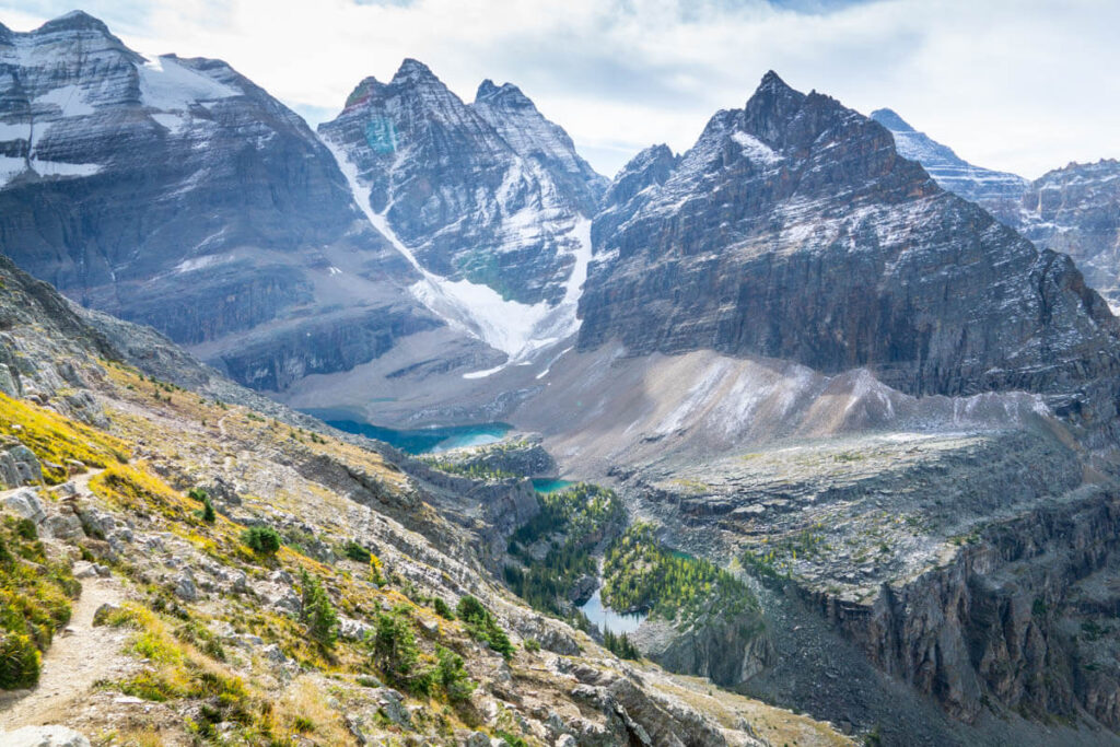
The Lake O’Hara Alpine Circuit
The Lake O’Hara Alpine Circuit is considered by many (including us) to be the best day hike in the Canadian Rocky Mountains. The alpine circuit is broken up into four segments, making it easy for hikers to pick the sections they wish to do on any given visit.

Traditionally, the Lake O’Hara Alpine Circuit is done in a clockwise direction starting with the Wiwaxy Gap trail, followed by the Huber Ledges and Yukness Ledges, finishing off with the All Souls Prospect trail.
Some may also add the Odaray Highline to Odaray Grandview Prospect, but there are strict daily visitation limits imposed by Yoho National Park, so you are not guaranteed access.

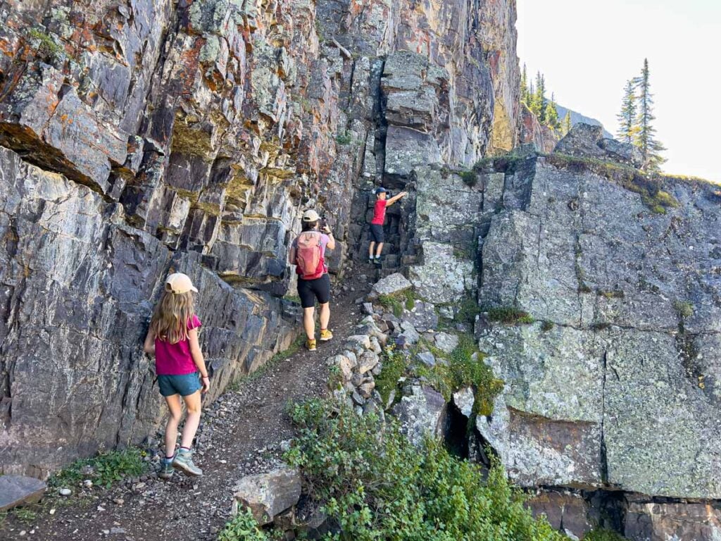
Wiwaxy Gap Alpine Trail
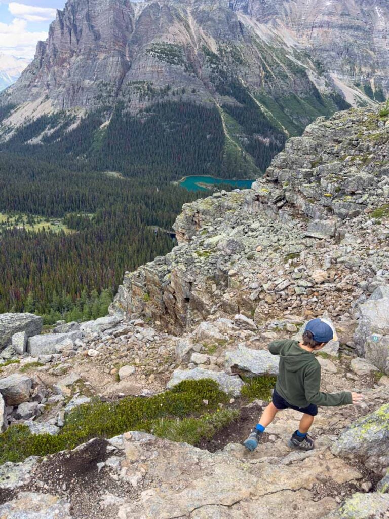
Traditionally the first leg of the Lake O’Hara Alpine Circuit, the Wiwaxy Gap Alpine trail is a very steep trail from the shores of Lake O’Hara to Wiwaxy Gap – a spot in-between the Wiwaxy Peaks and Mount Huber. The Wiwaxy Gap is an outstanding vantage point to enjoy views of the Lake O’Hara amphitheater as well as the mountains beyond.

To get to Wiwaxy Gap, you’ll hike up some short, tight switchbacks with a very steep incline. Along the way you’ll enjoy exceptional views of the alpine lakes and glaciers, walk along rocky ledges, and pass many larch trees.

There are some tight rocky ledges with significant drop-offs on the Wiwaxy Gap Alpine Route, which may affect anyone with a fear of heights.
Once at Wiwaxy Gap, you’ll enjoy a nice vista of the Canadian Rockies looking north, including Cathedral Mountain (3,189 m) and Mount Balfour (3,272 m). Looking back towards the Lake O’Hara amphitheater you can see two glaciers, at least 5 lakes and many distant mountains.

Huber Ledges Alpine Route
The Huber Ledges Alpine Route is a genuinely fun hiking trail. The Huber Ledges trail connects the Wiwaxy Gap with Lake Oesa. After a steep slog to Wiwaxy Gap, the mostly downhill Huber Ledges trail feels like a nice reward.
The Huber Ledges trail cuts across a very steep downhill slope along the south face of Mount Huber. Watch your step carefully here as a misstep could lead to serious trouble.

There are occasional tiny evergreen trees and/or larches, but you’ll be mostly above the tree line, allowing for outstanding views. At some points on the Huber Ledges trail can see as many as seven alpine lakes below you, including Lake Oesa at the far end of this alpine circuit trail.
Along the Huber Ledges trail, we enjoyed two excellent wildlife encounters – a cute little pika and a group of three mountain goats.

Yukness Ledges Alpine Route
An elevated trail running along the lower alpine slopes of Yukness Mountain (2,847 m), the Yukness Ledges trail is an elevated route connecting Lake Oesa to Lake Hungabee. Along the way, it provides some of the best views of Lake O’Hara you can get anywhere.
The Yukness Ledges trail begins through a grassy meadow with large boulders and larch trees scattered about. The views of Odaray Mountain (3,159 m) reflecting in the calm waters of Lake O’Hara below are amazing.
The first half of the trail is very rocky which will slow your pace. The rocks are so covered with lichen that you’ll think they are green.

As you pass the halfway point of the Yukness Ledges trail, you’ll reach the far eastern end of the lake. You’ll get some truly outstanding pictures of Lake O’Hara here.

As you finish the Yukness Ledges trail, the trail surface is much better and you’ll enjoy views of a large larch forest below along with a great sight line to the Opabin Glacier resting below Mount Biddle.

All Souls Prospect
The All Souls Prospect trail is the final leg of the Lake O’Hara Alpine Circuit. The 2 km All Souls Prospect trail connects the West Opabin Trail to Schaffer Lake along the northern alpine slopes of Mount Schaffer.
The trail begins with a steep climb through a rockfall with large boulders. It’s easy to get off the trail here, so watch for the blue and yellow trail markers (using AllTrails as a backup in case you get lost).
Once you reach the top of the boulder field, you’ll walk along a long, flat rock slab as you ascend to the shoulder of Mount Schaffer. Although the trail goes through rocks and scree, the trail is easy to walk and has good footing. From this vantage point on the Lake O’Hara Alpine Circuit, you’ll enjoy excellent views of Lake O’Hara and the Seven Veils Falls.
After reaching the highest point on the All Souls Prospect trail, the trail begins a relentless, very steep descent towards Shaffer Lake. If you’ve been hiking the Alpine Circuit since Wiwaxy Gap, your legs will be feeling it as you make your way down the final section of the All Souls Prospect trail.
We skipped the All Souls Prospect trail on our first two attempts of the Alpine circuit – the first was due to a lack of time, while the second was due to a lack of water supplies. But, we completed the Lake O’Hara Alpine Circuit on our third attempt. To be honest, it was my least favorite of the four sections of the Alpine Circuit. If you want to complete the entire circuit, then it’s still very worthwhile to hike, but if you don’t care about the status of hiking the entire Alpine Circuit, then don’t feel too bad for skipping it.
Download the Lake O’Hara Alpine Circuit Trail Map
Alpine Circuit Hiking Safety
The Lake O’Hara Alpine Circuit is a very difficult, and often dangerous hiking route. Please ensure you have the appropriate skills, gear and supplies to successfully complete the portions of the alpine circuit you choose to take on.
Parks Canada does not recommend alpine hiking prior to July 1 due to late snowpack conditions.
The Alpine Circuit has been marked with yellow and blue markings throughout the route.

Wildlife Safety
When hiking in Banff National Park, you are responsible for your own safety. Before hitting the hiking trails, we highly recommend you read our Essential Banff Hiking Tips for information about bear safety, trail conditions, wildlife warnings and possible closures.
What to Bring Hiking at Lake O’Hara
Given the remote location of Lake O’Hara, you’ll need to give some careful thought as to what to bring with you. Parks Canada recommends you dress in layers and bring sunscreen, hat, gloves, and rain gear and wear sturdy shoes or hiking boots.

Read More
Before hitting the trails around Lake O’Hara, check out our guide on what to wear for hiking in Banff and our list of essential hiking gear for Banff National Park.

Le Relais Day Shelter
There is a building adjacent to the bus stop with a few picnic tables out front. This is the Le Relais day shelter run by the Lake O’Hara Trails Club, who inspire Preservation Through Appreciation.
The Lake O’Hara Trails Club supports trail maintenance, visitor education and advocacy to protect this special area. The money they raise by selling snacks, drinks, books and t-shirts helps support their important work. The LOTC is famous for its carrot cake – buy yours early as it often sells out. Bring cash as they do not accept credit cards.

Please Note
While every effort has been made to provide timely and accurate information, please confirm your important details with Parks Canada before setting out for Lake O’Hara.
Support Human Created Content

Hi, we’re Dan & Celine Brewer, locals from just outside Banff National Park. Every article, itinerary, and recommendation we share is rooted in our real experiences and love for this place. If you’ve found our content helpful, please consider supporting us:
- Make a small donation: Your support directly fuels our work and keeps our stories genuine.
- Purchase a guide or itinerary: Essential tools that help plan your trip and support local creators at the same time.
- Book lodging or tours through our affiliate links: You pay the same price, but we earn a small commission that helps us keep producing content.
Thank you for valuing authentic, human-created content. Your support allows us to help even more Banff travellers!

Dan Brewer, a life-long Alberta resident, calls Canmore home along with his wife and two kids. He is the co-owner of Travel Banff Canada, where he gets to share his passion for the Canadian Rocky Mountains. Dan, along with his family, love being outdoors doing one of the many activities they enjoy in the mountains: hiking, mountain biking, paddleboarding, skiing, snowshoeing and cross-country skiing.
When he's not in Canmore enjoying one of his favourite local hikes, you can find him hopping on a plane to explore a new country with his family or working on one of their other two travel sites: Family Can Travel and Baby Can Travel.