The Opal Hills Loop is an enormously scenic, varied and interesting hike near Maligne Lake in Jasper National Park. Reputed to be one of the steepest trails in Jasper, we wanted to get up high to enjoy a bird’s-eye view of Maligne Lake. Not only did we love the lake views, but the mountain valley scenery on this hike was incredible. We couldn’t stop talking about how beautiful it was!
This post contains compensated links.
Opal Hills Loop Trail Highlights
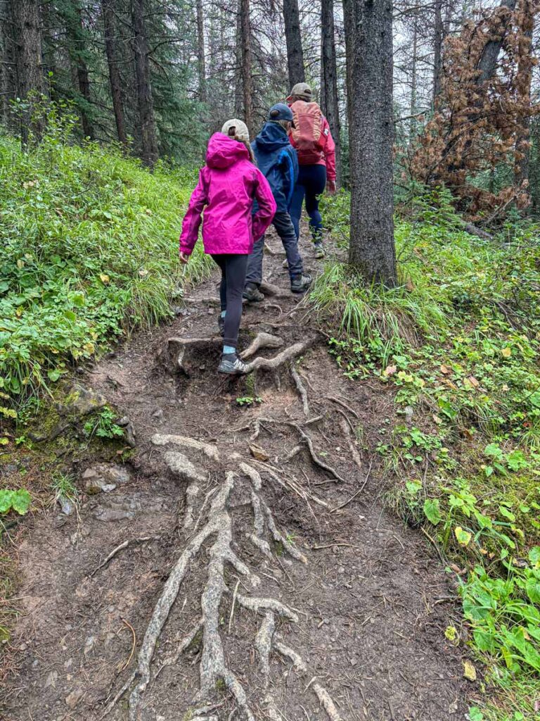
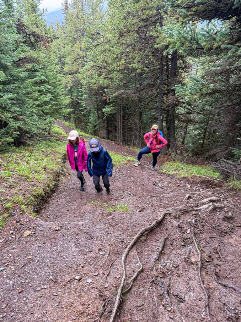
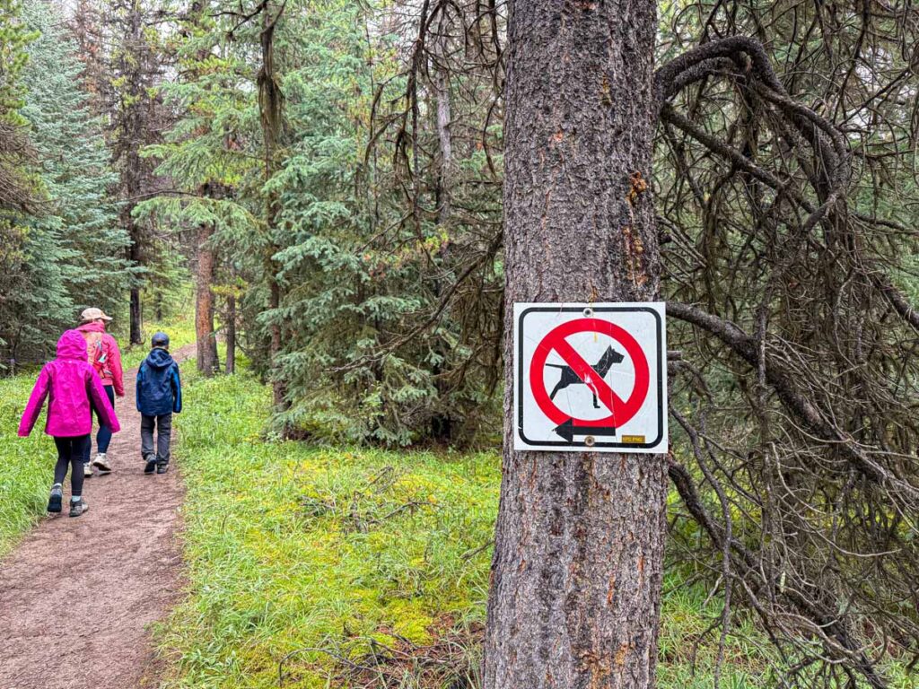
It was a cool and drizzly morning when we began our Opal Hills Loop hike. From the main Maligne Lake parking lot we followed the hiking trail into the forest. The tall grass, shrubs and many mushrooms were all wet from the morning rain. The hiking trail is wide enough for two people, but features a lot of tree roots.
After 200 m / 650 feet, the trail comes to a junction where you can continue on the Opal Hills trail or go right for the Mary Schaeffer Loop (one of the best easy hikes in Jasper, which follows the shores of Maligne Lake. We saw a moose on it a few days prior!)
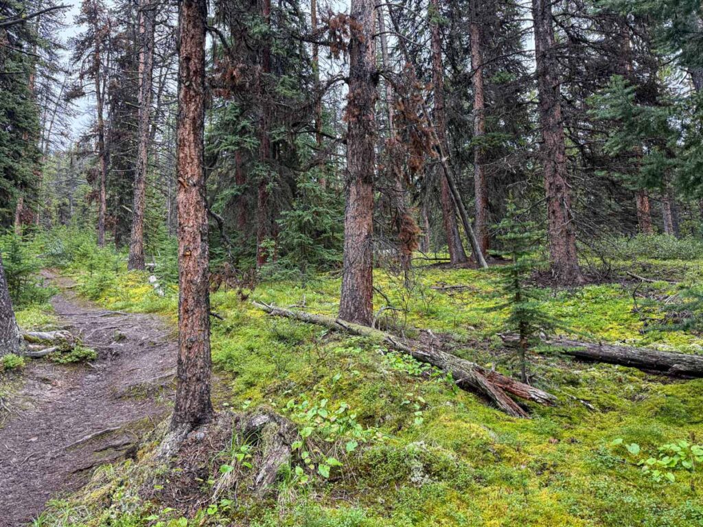
Beyond the Mary Schaeffer junction, the Opal Hills trail narrows to single track and starts to become uphill. I love the kind of forest here – the trees are nicely spread out, allowing you to see deep into the trees.
At the 0.5 km / 0.3 mile mark, the Opal Hills Loop trail starts living up to its reputation and becomes very steep. My heart got pumping pretty good, but the super steep section didn’t last long and the trail returns to a more typical uphill slope.
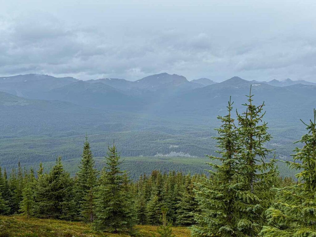
The Opal Hills Loop trail continues in this fashion for a while… repeating a pattern of a short, step section, following by a less steep section, and so on. If you need to take a break, look behind you as you can probably see the Bald Hills through the trees (the location of another popular Maligne Lake viewpoint hike).
Around the 1.6 km / 1 mile mark, we spotted what we believed to be some bear prints in the wet, somewhat muddy trail.
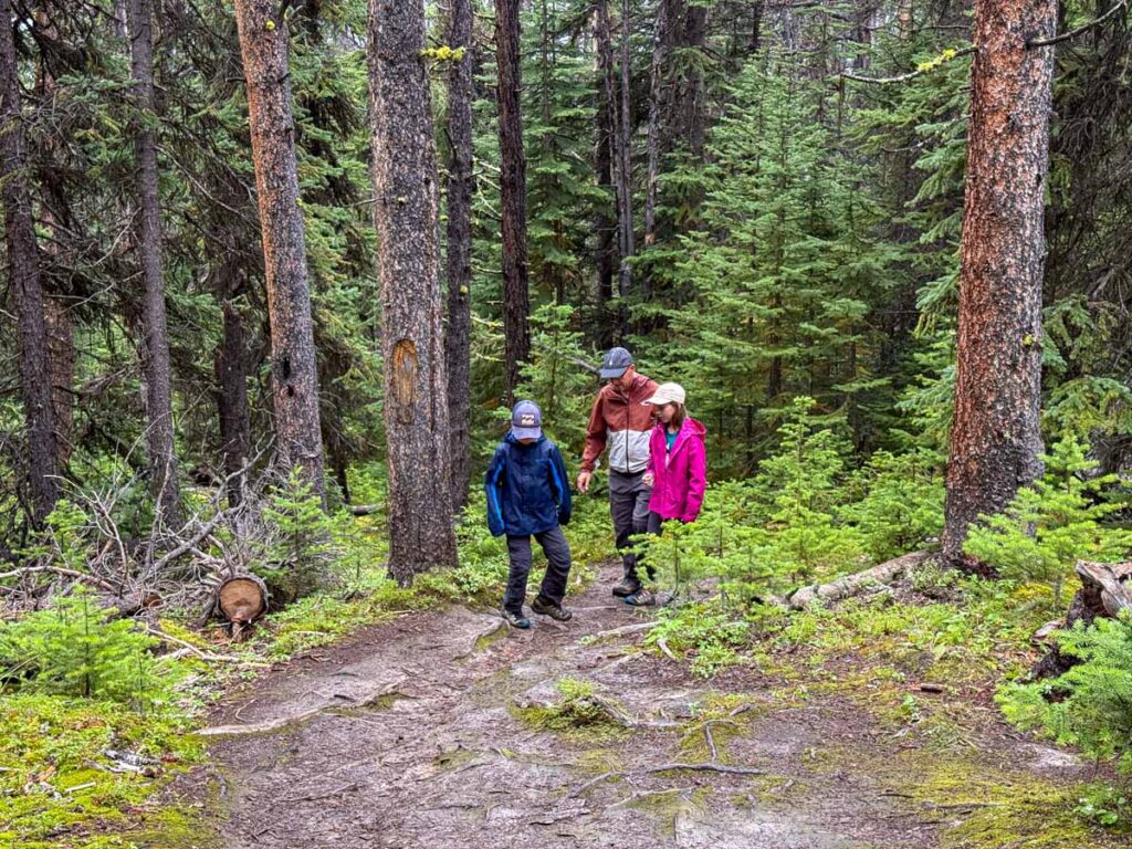
Just beyond the bear prints, we reached the junction for where the Opal Hills trail becomes a loop. Based on our pre-hike research, we chose to go right to complete the loop in a counter-clockwise direction. The steep / not-steep pattern continues for a while beyond the junction.
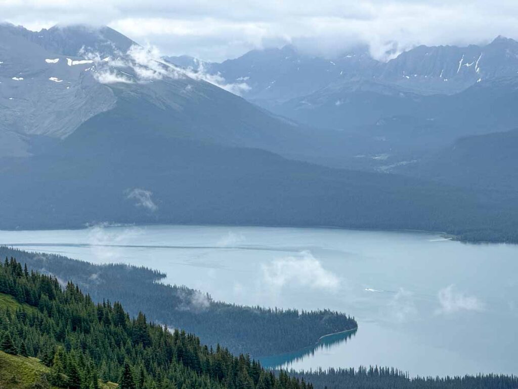
The trees start getting noticeably smaller after 2.6 km / 1.6 miles of hiking the Opal Hills Loop Trail, and they pretty much disappear shortly after that. With no trees around, the mighty Opal Peak (2,800 m) comes into view straight ahead.
At the 2.7 km / 1.7 mile mark, there’s another trail junction – this time to a spur trail leading to the viewpoint for Maligne Lake. It’s a short detour, with only 600 m / 200 feet of uphill hiking to get to the Maligne Lake viewpoint.
It had been drizzling all morning, but Mother Nature rewarded us with a beautiful rainbow over the valley below as we made our way to the viewpoint.
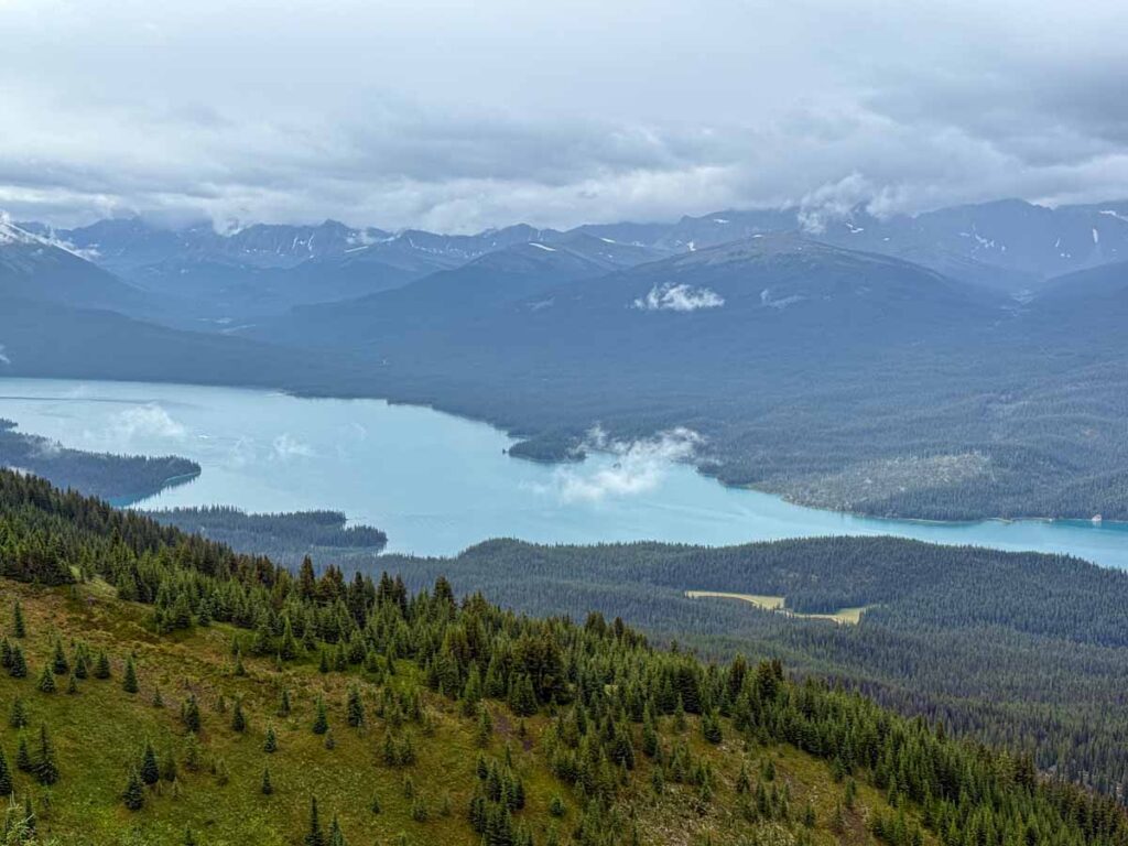
The vistas from the viewpoint are amazing and make the extra distance totally worth it. The star of the show is Maligne Lake, which has a remarkably beautiful water color, even on a cloudy, dreary day. But the views of the surrounding mountains were equally stunning.
From this vantage point, you can’t see Spirit Island, but we did see a boat from the famous Maligne Lake boat cruise. Off in the distance, we also noticed that you can see the glacier on the far shore of the lake.
Read More
The boat cruise is one of the top attractions in Jasper National Park. For more info, check out our post on the Maligne Lake Cruise.
The Maligne Lake viewpoint marks the highest point on the Opal Hills trail. Although the hike to the viewpoint was very steep in spots, we felt it wasn’t as hard as people make it out to be.
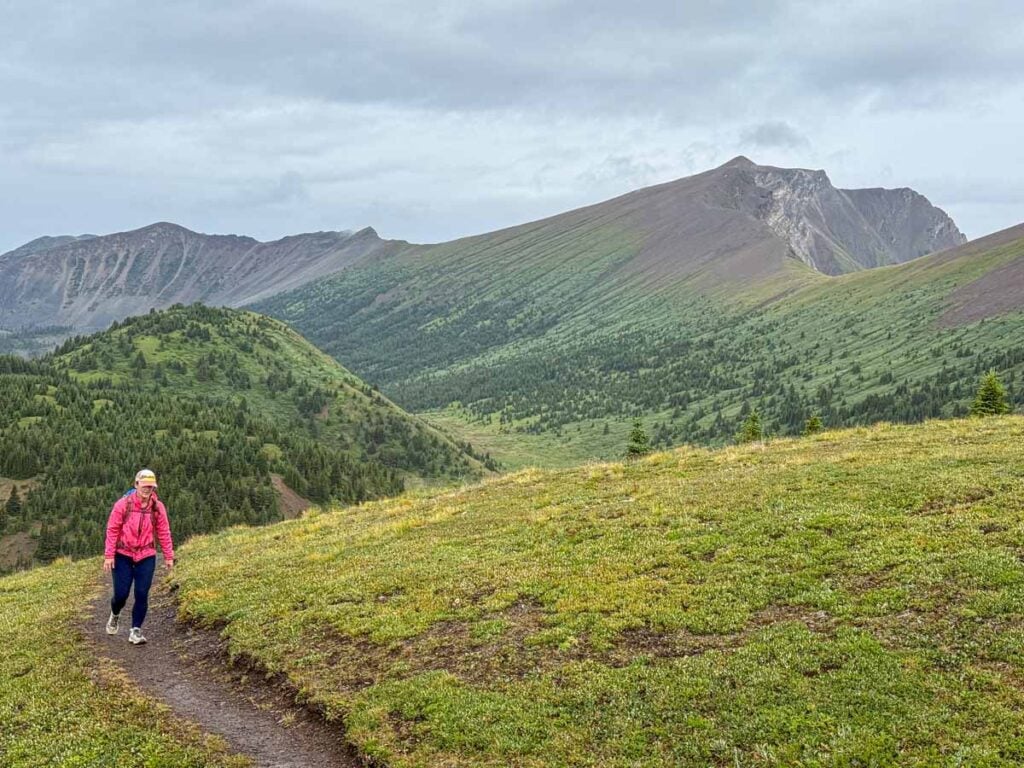
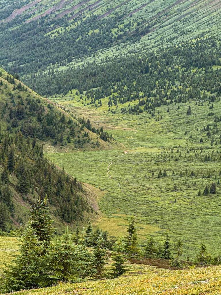
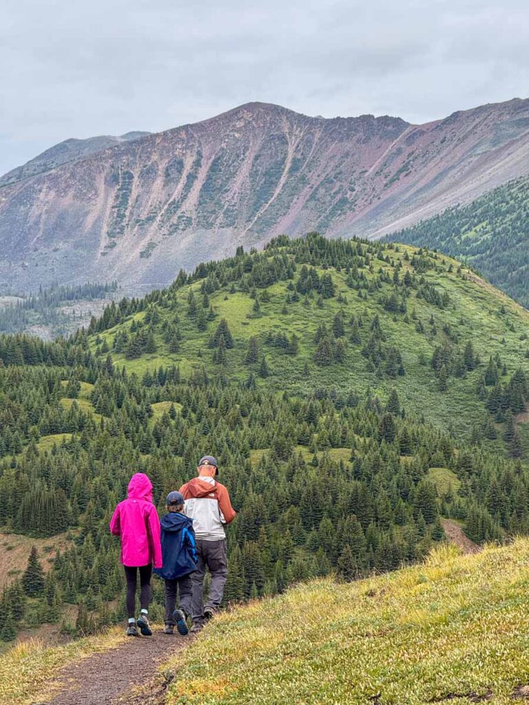
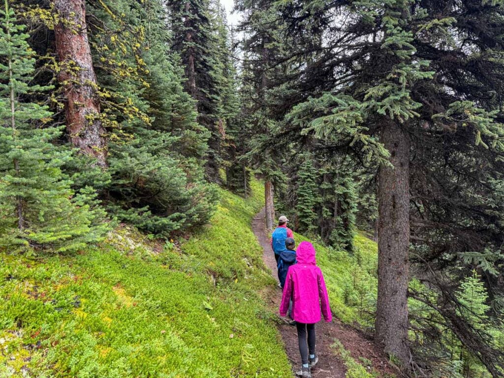
Coming back down to the main trail from the viewpoint, you can see the Opal Hills Loop trail in the distance in the valley below. The valley is a deep green with many small bushes. It looks so beautiful.
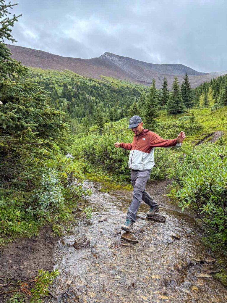
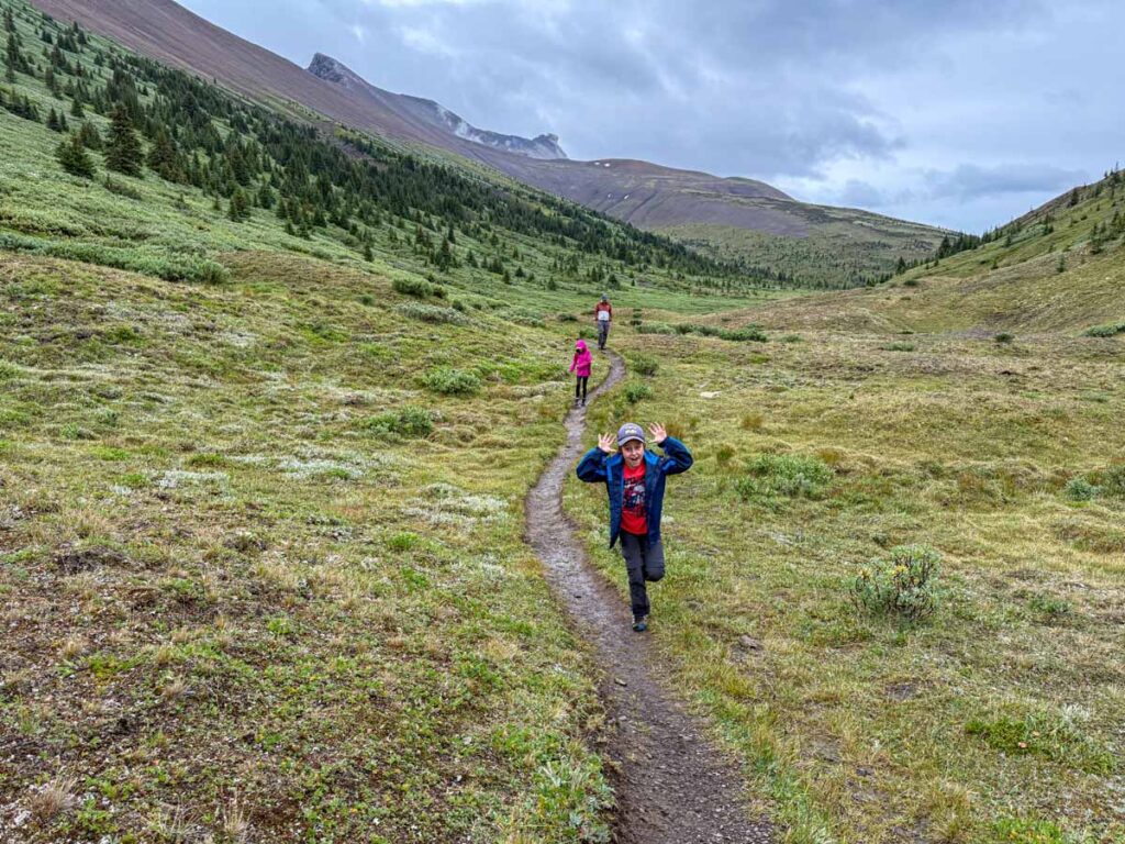
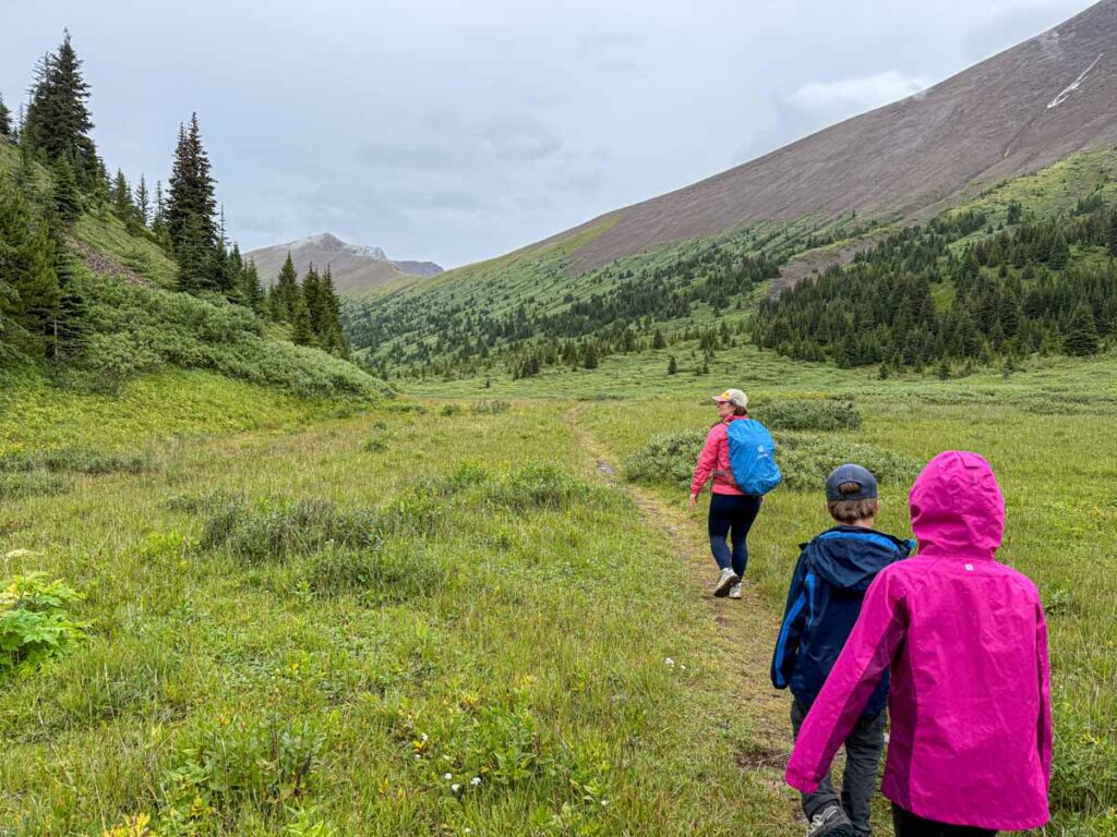
As predicted from above, the area in the valley bottom is gorgeous! Walking towards Opal Peak, there’s a cute little creek flowing next to the trail. Almost 4 km / 2.5 miles into the Opal Hills Loop hike, we crossed the little stream by hopping on a set of three rocks.
From here the trail enters the valley that we could see from the viewpoint spur trail. It’s just as beautiful from the bottom as we had hoped. There’s a wide green hill on the left and the Opal Peak ridge on the right. Even on a dreary day, we were blown away by the scenery.
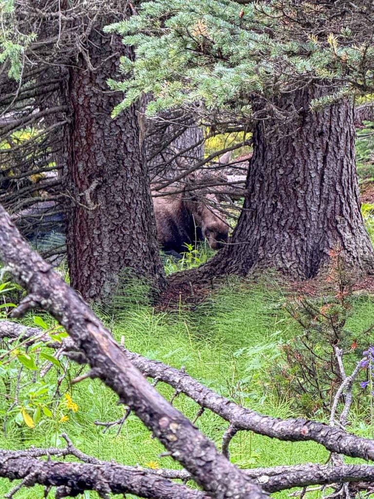
We had heard that this area is prime moose spotting territory, so we kept our eyes peeled, but all we saw was a ton of fat ground squirrels!
Around 5 km / 3.1 miles into the Opal Hills Loop hike, there’s a waterfall running down the side of Opal Peak. Once we crossed over its stream, the meadow ended and we reentered the forest. Here the shrubs were about shoulder-height with lots of wildflowers growing in-between. We passed several piles of bear scat on the trail, so we stopped looking for moose and started making a lot of noise.
Funny enough, as soon as we abandoned our search, we spotted a moose lying down in the trees about 15 feet off the trail! We were super excited to see a moose in its natural habitat (normally you only see them in the side of the highway). The moose was content to watch us take lots of pictures and videos, but we remained on high alert in case the moose changed its mind about our presence!
A few minutes later, a couple of hikers warned us they saw a black bear in the forest walking away from the trail. We pulled our bear spray cannister out of the holster (just in case) and made a ton of noise. We made it all the way to our car without seeing the bear… (we did see a grizzly on our way back to the Jasper townsite though!)
Read More
If you enjoy viewpoint hikes, don’t miss the Old Fort Point hike near the Jasper townsite!
OPal Hills Loop Trailhead
The Opal Hills Loop trailhead is located near Maligne Lake in Jasper National Park. There is a huge parking lot at Maligne Lake to support the iconic boat cruise, which is where we parked, but there is actually a better, separate parking lot for the Opal Hills Loop trail.
Maligne Lake is located about 48 km / 30 miles southeast of the Town of Jasper. The drive takes around 45 – 60 minutes, but it’s worth leaving early because Maligne Lake Road is one of the most scenic drives in the Rockies.
Directions to the Opal Hills Loop Trailhead Parking Lot

Recommended App
This GPS activated Canadian Rockies Audio Driving Tour is the perfect companion to your Banff vacation. It’s both entertaining and educational and will greatly enhance any drive in Banff National Park. Get 15% off with our Banff Discounts.
OPal Hills Loop Hike Stats
How Long is the Opal Hills Loop Hike?
If you hike the full Opal Hills Loop trail, plus the little side trail to the Maligne Lake viewpoint (which we highly recommend you do), the round-trip distance of the hike is 9.3 km / 5.8 miles.
How Hard is the Opal Hills Loop Trail?
Due to the multiple sections of steep uphill, we rate the Opal Hills Loop trail as a “challenging Jasper hike”.
As mentioned in the introduction, the Opal Hills Loop trail has a reputation as the steepest hiking trail in Jasper National Park. We haven’t hiked all the trails in Jasper, but we can confirm that when we reached the top of the hike, we thought it wasn’t as hard as we had feared.
To put some numbers behind it, the hike from the trailhead to the Maligne Lake viewpoint is 3.2 km / 2 miles long. Over this distance you will gain roughly 550 m / 1,800 feet in elevation. That’s an average slope of 17% – which isn’t easy. Also keep in mind that this uphill section alternates between flat and steep, so in reality, the uphill sections are much steeper than 17%.
The amazing news is that once the uphill is out of the way, so the final 2/3 of this hike is a nice, long downhill!
Whether or not it’s the steepest train in Jasper is up for debate, but not many will question that the Opal Hills Loop trail is a difficult Japer hike.
Read More
If you are looking for an easy hike without much elevation gain, check out our recommended easy hikes around Jasper (coming soon).
How Long Does the Opal Hills Loop Hike Take?
It should take a typical adult about 3.5 hours to enjoy the full loop around the Opal Hills trail. We’re pretty fast hikers, and it took us 3 hours and 20 minutes to do this hike with our two kids (12 and 10 years old). Our time includes breaks for photos, lunch, etc.
Opal Hills Loop Trail Map
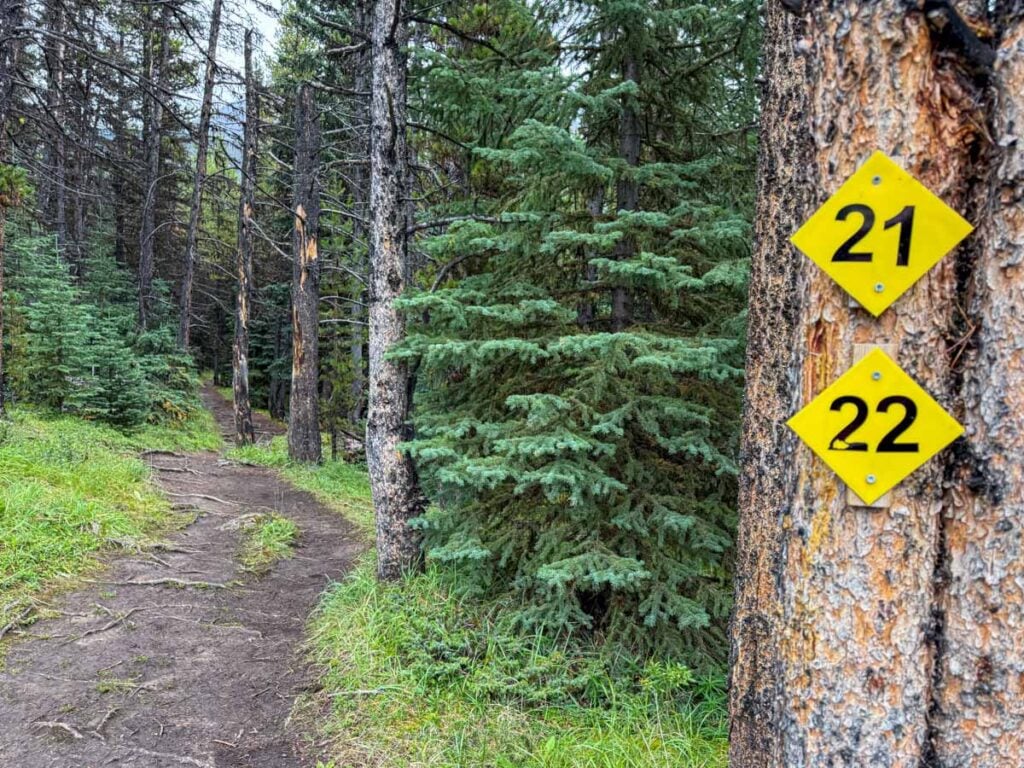
The Opal Hills Loop trail goes deep into the wilderness in Jasper National Park, so having trail map downloaded onto your phone is a good idea. There are several trail junctions along the trail, so having a trail map will give you peace of mind that you are on the right track.
To find the trail map in the AllTrails app, simply click here for the “Opal Hills Short Loop Trail Map”. Being in such a remote location, you won’t get a cell signal, so I recommend downloading the trail map prior to leaving.

Note: The AllTrails map does not show the side trail to the Maligne Lake viewpoint as part of the official hiking trail, but it’s a must-do part of the Opal Hills Loop trail – don’t miss it!
A recent App of the Year winner, AllTrails is also one of the best apps for visiting Banff! Enjoy map downloads and many more premium features with a 7-day free trial of AllTrails+!
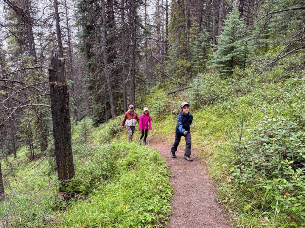
Hiking The Opal Hills Loop with Kids
Whether or not you should hike the Opal Hills Loop trail with kids will be highly dependent on your kids fitness level and hiking abilities. While I strongly believe that most kids are way better hikers than most people give them credit for, the Opal Hills Loop trail is a challenging Jasper hike and should only be attempted by families who hike regularly with their kids and know their capabilities.
Our kids (10 & 12) have grown up in the Canadian Rockies, and had very little difficulty hiking the Opal Hills Loop trail. Yes, they were huffing and puffing along the uphill section to the Maligne Lake viewpoint, but they made it without any issues.
Read More
If your family trip also takes you to Banff National Park, don’t miss these amazing Banff day-hikes with kids.
Opal Hills Loop Hiking Safety
Your biggest safety concern on this scenic Jasper hike is the steep uphill to the first viewpoint, and the corresponding downhill on your return. The steep slope may cause some traction issues, so be mindful of your steps. If you have knee concerns, you may appreciate having some hiking poles for the descent.
Wildlife Safety
When hiking in Banff National Park, you are responsible for your own safety. Before hitting the hiking trails, we highly recommend you read our Essential Banff Hiking Tips for information about bear safety, trail conditions, wildlife warnings and possible closures.
Opal Hills Loop Trail Logistics
- Unlike most trails in Jasper, dogs are NOT allowed on the Opal Hills Loop hike.
- Mountain biking is also not allowed.
- There are toilets in the parking lot.
- You won’t get cell service for the entirety of your hike, so don’t count on it for your safety. Download your trail maps beforehand.
What to Bring for Hiking the Opal Hills Loop Trail
This is a long, challenging Japer hike, so you should come prepared for any eventuality. If you are considering hiking the Opal Hills loop, you probably have a good handle on what this means, but if not, check out our list of hiking essentials and hiking clothes to get the most enjoyment out of your hike, regardless of the variable weather and trail conditions.
The Opal Hills Loop trail is a steep & challenging hike to an amazing viewpoint of Maligne Lake. It’s considered one of the steepest hikes in Jasper, but the vistas from the top make it all worthwhile!
Support Human Created Content

Hi, we’re Dan & Celine Brewer, locals from just outside Banff National Park. Every article, itinerary, and recommendation we share is rooted in our real experiences and love for this place. If you’ve found our content helpful, please consider supporting us:
- Make a small donation: Your support directly fuels our work and keeps our stories genuine.
- Purchase a guide or itinerary: Essential tools that help plan your trip and support local creators at the same time.
- Book lodging or tours through our affiliate links: You pay the same price, but we earn a small commission that helps us keep producing content.
Thank you for valuing authentic, human-created content. Your support allows us to help even more Banff travellers!
Love our content? Sharing our post is the easiest way to support us!

Dan Brewer, a life-long Alberta resident, calls Canmore home along with his wife and two kids. He is the co-owner of Travel Banff Canada, where he gets to share his passion for the Canadian Rocky Mountains. Dan, along with his family, love being outdoors doing one of the many activities they enjoy in the mountains: hiking, mountain biking, paddleboarding, skiing, snowshoeing and cross-country skiing.
When he's not in Canmore enjoying one of his favourite local hikes, you can find him hopping on a plane to explore a new country with his family or working on one of their other two travel sites: Family Can Travel and Baby Can Travel.